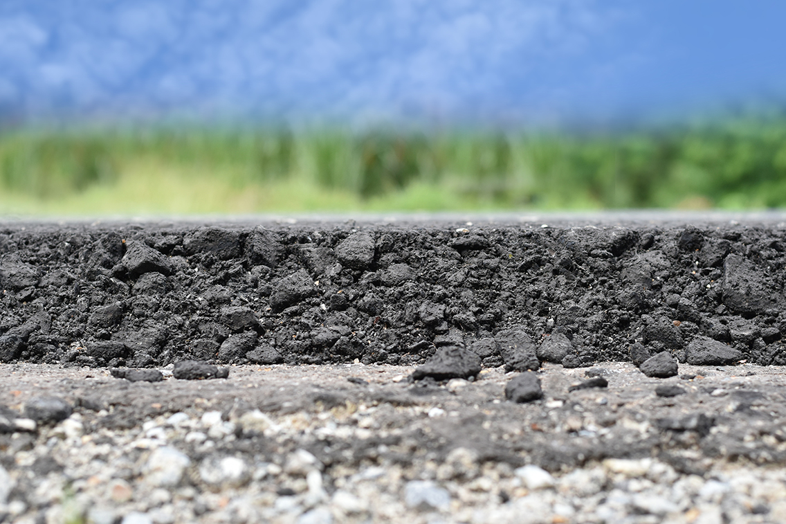
Parking Lots Paving – Hot Mix Asphalt (HMA) Recommendations

Tom Wood, Pavement Specialist, WSB

Pavement mixes used to build streets, highways and parking lots are not the same. There are several different mix requirements that are applied to each based on the use of the surface.  Parking lots carry a low amount of daily traffic, but experience wear and tear due to static loading or from serving as a rest area.  Rest areas and truck stops have a high number of creep speed Equivalent Single Axle Loads (ESALs). ESAL is a concept developed from data collected at the American Association of State Highway Officials.  It is a road test that measures the damage relationship and the effects of axles carrying different loads.

When determining pavement mix, a parking lot’s classification must be established. Parking lots are divided into two classifications: passenger vehicle parking and commercial vehicle parking.  In some cases, parking lots serve as both passenger vehicle parking and commercial vehicle parking. These parking lots require special considerations.

The Minnesota Department of Transportation (MnDOT) has developed mix designations that are included in their Standard Specifications for Construction Book. All project documents submitted must be in accordance with the book. Mixture designations are coded and outlined for their specifications using SPWEA430C.

SP  | Design Type

Superpave, which is a gyratory compactor design used for all asphalt mixtures. This is the latest design used to replace the Marshall mix design method.

WE  | Lift course

  • WE indicates wear and shoulder wear, which is the top 4 inches of asphalt on MnDOT projects, or top 3 inches on local projects.
  • NW indicates non-wear course, which lies below the top 4 inches of asphalt on MnDOT projects or top 3 inches on local projects.

A  | Maximum Aggregate Size

2360 Gyratory Maximum Aggregate Size
A -1/2”
B -3/4”
C -1”
D -3/8”

 | Traffic Level

The traffic level is based on the ESAL or the annual average daily traffic (AADT).  Higher traffic levels require a higher-level percent of crushed aggregates.  This will reduce the effects of rutting on pavement caused by traffic loading when soft mixes are used.

Traffic Level Million ESAL AADT
2 < 1 < 2,300
3 < 3 < 6,000
4 < 10
5 > 10

30 Air Void Requirement

  • 40 for 4.0 percent air void. This is usually used on a surface with high traffic levels. The traffic helps compact the asphalt mixture.
  • 30 for 3.0 percent air void. This is usually used on surfaces or roadways with low traffic level.

C  | Performance Grade (PG) Binder Type

               2360 Designation Binder Grade
A PG 52S-34
B PG 58S-28
C PG 58H-34
E PG 58H-28
F PG 58V-34
H PG 58V-28
I PG 58E-34
L PG 64S-22
M PG 49S-34

The first numbers of the binder type are the average seven-day maximum pavement temperature (oC) and the second number is the expected minimum pavement temperature (oC). The letters dictate the traffic level. “S” grade is for standard traffic, “H” grade is for heavy traffic, “V” grade is for very heavy traffic, and “E” grade is for extremely heavy traffic.

Example – Binder Type A:

A PG 52S-34 is intended for use where the average seven-day maximum pavement temperature is 52 degrees Celsius and the expected minimum temperature is -34 degrees Celsius, under standard traffic conditions.

Parking lot mix types:

Below are some recommendations on mix types that will help enhance the overall performance of the parking lots.

Classification New Construction or Reconstruction Mill and Overlay
Passenger Vehicle Parking Only SPWEA430C SPWEA430B
Commercial Vehicle Parking SPWEA530F / SPWEA530I SPWEA530H

Aggregate Size

  • Aggregate size A is recommended due to the smaller size aggregate yielding a smooth finishing surface.

Traffic Level

  • Traffic level 4 will help limit the depression in the parking stalls for passenger vehicle parking only.
  • Traffic level 5 includes an increased percentage of crushed aggregate that helps mitigate creep speed ESAL from trucks.

Air Void Requirement

  • A 3.0 percent air void will provide a tight finishing surface and an aesthetically pleasing look.

PG Binder Type

  • The binder type used in a mill and overlay is generally lower than what is used in new construction or reconstruction. Cracks on existing underlying pavement reflect through the new overlay over time. This method is not as cost-effective as a higher binder grade. This does not mean that a higher binder grade in any mill and overlay project should not be used.  A high binder grading helps slow down thermal cracking.  It is at the discretion of the designer to decide if it is cost-effective to delay the reflective cracking.
  • On commercial vehicle parking surfaces, asphalt binder grade F is a sufficient option, but in extreme conditions a higher binder grade I (PG 58E-34) should be used to reduce rutting and shoving.
  • Surface areas where trailer landing gears are down should be designed with concrete pavement to support concentrated loads.

The recommendations above are guidelines. Additional investigation is necessary and should include coring or boring to further evaluate the subsurface conditions prior to a design work.

WSB receives CEAM Honor Award

WSB receives honorable mention for Project of the Year from the City Engineers Association of Minnesota (CEAM)

WSB’s Afton Old Village Preservation Project received an honorable mention for Project of the Year at the City Engineers Association of Minnesota (CEAM) Annual Conference on Wednesday, January 30.  Each year, CEAM honors the special achievements of engineers and recognizes outstanding engineering projects at their Annual Conference. This is the second consecutive year our firm has received an honorable mention for Project of the Year. Our firm was recognized for our contributions to the St. Anthony Village Advanced Oxidation Water Treatment Plant in 2018.

Afton Old Village Preservation | CEAM Project of the Year Honorable Mention

WSB worked with the City of Afton and Washington County to reconstruct the 160-year-old Old Village of Afton.  The project revitalized the Old Village of Afton, protecting the historic properties and restoring the opportunity to revitalize the downtown area of the City. This $20 million, eight-year effort included new sanitary collection and treatment system; reconstruction of all County and local roads; new trails; levee reconstruction; stormwater enhancements, ADA improvements and provided 100-year flood protection to protect the Old Village of Afton over the next century.

WSB receives ACEC-MN Honor Awards

WSB receives Honor Awards from American Council of Engineering-Minnesota (ACEC-MN)

On Friday, January 25, the American Council of Engineering-Minnesota (ACEC-MN) awarded WSB  two Honor Awards for the Afton Old Village Preservation and Corridors of Commerce – Scope and Project Selection at the Excellence in Engineering Awards Banquet in Minneapolis.

For over fifty years, the association has been recognizing outstanding engineering projects through their awards program.  Minnesota engineering firms across the state enter their most innovative projects and studies hoping to be recognized for the work they’ve done to make the state stronger.

Afton Old Village Preservation | ACEC Honor Award

WSB worked with the City of Afton and Washington County to reconstruct the 160-year-old Old Village of Afton.  WSB led an eight-year process that assembled the project vision, procured stakeholder funding, prepared preliminary design, final design, construction administration and coordination with tribal communities.  The project revitalized the Old Village of Afton, protecting the historic properties and reinvigorating the downtown area of the City. This $20 million effort included a new sanitary collection and treatment system; reconstruction of all County and local roads; new trails; levee reconstruction; stormwater enhancements, ADA improvements and provided 100-year flood protection to protect the Old Village of Afton over the next century.

Corridors of Commerce – Scope and Project Selection | ACEC Honor Award

WSB’s Transportation and Structures Group assisted the Minnesota Department of Transportation (MnDOT) in evaluating proposed projects for the department’s Corridors of Commerce program. Created by the Minnesota Legislature in 2013, the program is tasked with adding additional state highway capacity and reducing barriers to commerce. MnDOT requested public input to identify the location of transportation chokepoints and needed improvements in the state’s highway system. Using high-performance software, the project team was able to develop a concept design plan for each of the 167 projects, providing data to analyze against MnDOT’s evaluation criteria. This concept work was completed for all 167 projects within a handful of weeks.


Taking a Strategic Approach to Water Quality Management

By Tony Havranek, Sr. Ecologist, WSB

Boating, fishing, swimming, and enjoying a day near a lake, river, or stream is part of Minnesota’s culture. Unfortunately, nearly 40 percent of Minnesota’s lakes and streams are included on the Minnesota Pollution Control Agency’s (MPCA) Impaired Waters List. (See the list at https://bit.ly/2BwTk3r.)

Meeting surface water quality standards requires monitoring pollutants that can affect the physical, chemical, or biological makeup of surface water. Phosphorus is one of the main pollutants in the state’s bodies of water. Phosphorus is a pollutant that comes from both external and internal loading sources. Today, Minnesota law limits the use of fertilizers containing phosphorus, but prior to these limits, phosphorus was widely used in several commonly used chemicals settling in our lakes, rivers and streams. Meeting water quality standards requires a reduction of phosphorus in the water column. A water column is the vertical section of water from the surface to the bottom of a body of water.

External sources include stormwater runoff, atmospheric deposition, and directed pipe runoff. Internal sources include sediment suspension, aquatic vegetation, and an overabundance of rough fish. Both internal and external loading sources contribute to surface water quality degradation.

Managing water quality is not only important to the community and the people who live and work there, but it also drives ecological integrity. Because of this, water quality is regulated by federal, state, and local governments.

Where to start
With the appropriate funding and expertise, it is possible to solve water quality challenges and get bodies of water removed from the MPCA Impaired Waters List. Fortunately, numerous funding resources are available through grants, partnerships, and coalitions.

Since water is continuous across landscapes, developing partnerships is often the most cost-effective way to approach managing water quality. It lessens financial burdens and helps many communities achieve long-term success. It also creates opportunities for communities to create long-term plans to improve and protect water quality.

To begin to make improvements, it’s important to understand a community’s water quality issues. Start putting the pieces of the puzzle together by quantifying the scale and source of the pollutant before selecting an approach. The MPCA’s website offers information on a body of water’s total maximum daily load (TMDL) at https://bit.ly/2BbsrVH.

The TMDL is the maximum amount of pollutant a body of water can receive without exceeding water quality standards, and allocates pollutant loads from internal and external sources. In other words, the TMDL identifies all sources of a pollutant and determines how much each source must reduce its contribution.

TMDL implementation actions
Once the TMDL is identified for each body of water, a plan of action can begin to be shaped. Several methods can be implemented to begin to improve water quality.

Public education and outreach. Fertilizers have a major impact on water quality and ecosystems, creating a chain reaction. Excess phosphorus found in fertilizers creates algae blooms. As algae decomposes, oxygen is removed from the water. A lack of oxygen in an aquatic ecosystem effects the native species in a body of water. Educating the public of the harmful effects caused by fertilizer runoff can help limit the amount of phosphorus or other nutrients that flow into bodies of water.

Structural best management practices (BMPs). The MPCA defines a BMP as a stationary and permanent structure that is designed, constructed, and operated to prevent or reduce the discharge of pollutants in stormwater. BMPs can be used for on-site or regional treatment and help a community take a more strategic approach to managing its water quality.

Carp management. Internal loading of phosphorus can be caused by an overabundance of the invasive common carp. High levels of phosphorus cause algae blooms, reduced clarity, loss of aquatic plant and fish habitats, and a threat to human health. Managing and mitigating carp populations improves long-term overall water quality and ecological integrity.

Vegetation management. Invasive aquatic vegetation displaces native vegetation and can release phosphorus into the water column. Vegetation management can help solve this problem. Strategically placed native vegetation can help protect soil from erosion and reduce surface water runoff. Stormwater is then held in place and slowly released, rather than flowing directly into the body of water. Native aquatic vegetation can also help reduce phosphorus-laden sediments through wind and wave action.

There isn’t a silver bullet that can solve a community’s water quality challenges at once, but these are several proven options that can lead to improved water quality and ecological integrity.

This article was originally published in the January/February 2019 issue of League of Minnesota Cities magazine.

Slope Failure

When people think of slope failure or geohazards, they think of landslides and mudslides in mountainous regions like California. Those of us living in the Midwest don’t typically worry about property damage or disruptions in public services due to slope failure. Unfortunately, slope failure impacts a wide range of landscapes, even those considered relatively level. In fact, in the Twin Cities there have been increasing numbers of slope failures that significantly impacted infrastructure and property. The most recognizable example is probably the 2014 slope failure along the West River Parkway in Minneapolis. This slope failed after more than 11 inches of rain fell in two days, impacting a popular recreational trail as well as a major health care facility. Repairs were completed in 2016, and cost $5.639 million [i].

Slope failure is a geohazard that impacts many types of infrastructure, from individual homes to municipal storm sewer networks to oil and gas pipelines. In fact, the Pipeline and Hazardous Materials Safety Administration requires that natural gas and hazardous liquids pipelines develop risk assessment programs for slope failures in their systems. Likewise, many municipalities are beginning to incorporate these types of risk assessment programs into their own planning activities.

So what causes slope failures? Like all geohazards, the causes are myriad and complex. Establishing a framework of how the physical processes behind slope instability function is crucial in determining risk.
Simply put, slope stability is based on the interaction of two forces: driving forces and resisting forces. Slope failures occur when driving forces overcome resisting forces. The driving force is typically gravity, and the resisting force is the slope material’s shear strength.

When assessing a slope’s stability look for indications that physical processes are decreasing shear strength. These can include:

  • Weathered geology: Weak, weathered bedrock, jointed rock, or bedrock that dips parallel to the slope can decrease stability.
  • Vegetation removal: Droughts, wildfires and humans can remove vegetation from the slope, decreasing stability.
  • Freeze/thaw cycles: Water in rock joints or in soils can decrease slope stability.
  • Stream action: Rivers can erode the bottom of the slope, called the toe, decreasing stability. This can occur over time through normal stream action or catastrophically during flood events.
  • Human modifications: Humans modify stability through actions such as excavation of the slope or its toe, loading of the slope or crest, surface or groundwater manipulation, irrigation, and mining.
  • Slope angle: Steeper slopes tend to have greater risks for instability.
  • Soil type: Soils have variable amounts of shear strength, dependent on factors such as soil texture, pore water, and particle cohesion.
  • Water sources: Water works in many ways to reduce shear strength. For example, pore water pressure in soils decreases shear strength, and saturated soils are more likely to lead to slope failure. Perched water tables, groundwater seeps, and excessive precipitation are some examples of water sources that may lead to slope failure in certain conditions.

Many things can impact the stability of a slope. Just like with stream crossings, all geomorphic factors affecting slope stability should be considered when determining the risk of slope failure.
After the geomorphic factors for each slope crossing have been adequately assessed, these indicators can be fed into our geomorphic framework of slope stability to determine how likely slope failure is at a particular location.

An example of a risk matrix developed for slope stability is below. This matrix is determining the likelihood that a slope failure will occur and multiplying that by a known consequence to derive a risk factor (from the formula above). For this type of risk matrix to work, robust rational and consequence definitions should be developed to support the risk estimation. In this example, geomorphic analyses have resulted in a specific set of justifications for the likelihood of slope instability. These categories are then assigned risk factors. Very Low stability slopes, as defined by the rational in the matrix, have an Almost Certain (5) risk factor.

Detailed definitions have also been determined for the Failure at Road consequence, and those definitions are assigned risk factors. A slope failure at a road is considered Critical (5) if the road is a critical evacuation route, major transportation corridor, or restricts access to emergency facilities. Almost Certain (5) slope failures at Critical (5) roads have a Risk Factor of 25 and require mitigation.

While this example matrix only lists one consequence category (Failure at Road), a risk matrix can be designed to include as many consequences as necessary to capture the complete risk profile. Additionally, the application of five risk factors is merely an example. Risk matrices can be designed with as many or as few risk factor categories as necessary.

The outcome of this analysis is a set of risk factors that pipeline operators, city planners, engineers, or transportation officials can use to prioritize capital spending in a non-biased way, proactively estimate capital budget, manage interim risks, and more accurately estimate maintenance budgets.

[i] https://www.minneapolisparks.org/_asset/hwlxv3/west_river_parkway_faq.pdf
Photo: http://www.windomdam.com/CSS/2008-11-18%20Letter%20to%20City%20Responding%20to%20the%20SEH%20Feasibility%20Report.htm

The Roundabout Craze

Andrew Plowman, Transportation Project Manager, WSB

Roundabouts have been used throughout Europe and Australia for decades but have only gained popularity in the United States in the past 20 years. There are currently more than 3,500 roundabouts in the United States. Minnesota has also joined the roundabout craze, with more than 140 roundabouts built as of 2014, and upward of 20 additional roundabouts built each year.

Some jurisdictions, such as the New York State Department of Transportation and the City of Bend, Oregon, have implemented a “roundabouts first” policy. These policies require that a roundabout be analyzed and, if feasible, should be the preferred option.

To understand why roundabouts have become so popular, it is important to understand what a roundabout is and why roundabouts perform so well compared to other intersection alternatives.

What is a roundabout?
A roundabout is a type of intersection that includes a circular central island and lane(s) traveling around the central island in a counterclockwise direction. A roundabout is different from traffic circles and rotaries.

There are four main differences between rotaries/traffic circles and modern roundabouts:

Right of way

  • In a roundabout, vehicles already within the circle have the right of way.
  • In a rotary or traffic circle, entering vehicles have the right of way.

Size

  • Roundabouts are comparatively smaller (typically 80-180 feet in diameter).
  • Rotaries and traffic circles can be as big as 300-400 feet in diameter.

Changing lanes

  • Changing lanes within a roundabout is not allowed. Lane integrity must be maintained through to exit.
  • Changing lanes is allowed in rotaries and traffic circles (though sometimes this is difficult, as shown in the famous scene from National Lampoon’s European Vacation).

Deflection upon entry

  • Deflection is crucial to appropriate roundabout design, as it promotes lower speeds and encourages yielding.
  • In a rotary or traffic circle, entering traffic aims to the right of the central island, which does not promote lower speeds or yielding.

How to drive a roundabout
Roundabouts can have a variety of configurations, depending on the capacity requirements on each approach. Driving a single-lane roundabout is easier than driving a multi-lane roundabout, but the basic concept is the same. The primary concept to understand for a single-lane roundabout is this: yield to pedestrians at crosswalks and to vehicles to your left within the circulating lane.


Multi-lane roundabouts add one more step to the direction listed above: choose the appropriate lane. For example, choose the left lane if you are going left or through, and choose the right lane if you are going right or through. (Yellow line: left or through; Blue line: right or through)

Benefits of roundabouts
Compared to standard intersections, roundabouts offer significant benefits.

  • Safety: This is one of the primary reasons roundabouts have become so popular. Research shows that roundabouts reduce fatal and injury accidents by as much as 76%, due to slower speeds and the existence of fewer conflict points.
  • Capacity and reduced delay: Due to the continuous flow of traffic, roundabouts can handle larger volumes than signalized intersections in the same amount of time. It is a common misconception that intersections are more efficient.
  • Better fuel efficiency and air quality: There is less idling by vehicles in a roundabout than in an intersection where vehicles must wait through red lights. This equates to a reduction in fuel consumption and vehicle emissions.
  • Landscaping opportunities: The central island of a roundabout is a great place to provide landscaping and can serve as a gateway to a community or district.
  • Safety for pedestrians: This is another common misconception about roundabouts. It is often thought that because a pedestrian crossing at a roundabout is uncontrolled, that it is not as safe as a signalized crossing. The figures below illustrate why the roundabout crossing is safer than crossings in standard intersections.

Roundabouts are being implemented in communities throughout Minnesota and continue to score well on many federal grant programs. We continue to stress the importance of educating drivers about how to properly navigate a roundabout, through ongoing communication with the public across multiple platforms.

Robert’s Rules of Order

By John Powell

Robert’s Rules of Order were first published in 1876 and were named for Colonel Henry Martyn Robert, a military engineer in the United States Army. Robert developed the rules after being asked to conduct a meeting at his church. Due to his inexperience in this role and no shared understanding among the attendees as to how a meeting should be conducted, the outcome was unproductive and disappointing. Robert recognized the need for a uniform understanding of parliamentary procedures and went about developing a reference document.

Robert’s Rules of Order provide a basis for the conduct of public meetings and a framework for the decision-making process. This guide to parliamentary procedures helps ensure that the rights of all participants in the process are recognized and considered. Having a set of rules to follow for decisions can be particularly useful in very contentious situations where there may be very differing and heated opinions.

How to apply Robert’s Rules of Order

The chair or other designated leader of the meeting should have a familiarity with Robert’s Rules of Order as well as any other rules specific to the organization. Even if an organization adopts Robert’s Rules of Order for the proceedings, other rules of the organization may still take precedent. While the specific rules are very detailed and extensive, in most cases conducting business first involves someone putting forth a motion for the assembly to take some sort of action. Most motions require a second, meaning another member agrees that the motion should be considered; this is to prevent a single member from consuming the assembly’s time with matters of importance only to them. Once seconded, the issue is debated and can be amended before a vote is taken.

During debate, assembly members should focus their comments and discussion on the question at hand, address their comments to the presiding officer (chair, mayor, etc.), and leave out remarks related to the personalities or motives of others. On occasion at City Council meetings, the City Attorney may be consulted to provide guidance regarding specific steps that must be taken, as they generally have the most in-depth understanding of statutes and other local rules.

Southwest LRT Groundbreaking

One of Minnesota’s largest infrastructure projects officially moves into construction.

WSB acted as West Segment Water Resources Lead for Metro Transit. 

Federal, state, and local officials gathered in Hopkins to break ground on the Southwest LRT project in late November. The $2.003 billion project will be the largest infrastructure project in the state’s history and is expected to create 7,500 construction jobs, with an estimated $350 million payroll.

Our Water Resources and Environmental Compliance teams assisted Metro Transit as the West Segment Water Resources Lead. We completed the erosion and sediment control design, storm sewer design, permitting, bridge and wall drainage work. Our team was also responsible for identifying and designing Best Management Practices (BMPs) to meet permitting requirements and designed the storm sewer infrastructure that will connect existing municipal and Minnesota Department of Transportation (MnDOT) systems to one another. Additionally, we prepared water resources-related documents, including preparing plans and specifications, quantifying wetland and floodplain impacts, completed hydraulic analysis for risk assessments and performed water quality analysis of the proposed BMPs.

Inflow and Infiltration (I/I) in the Twin Cities

By Marcus Bush

It’s a mouthful. And it happens every day in every wastewater system, but it happens without many of us knowing about it. The sources vary, the flows vary, and the solutions vary, but the motivation to mitigate I/I is the same. The addition of excessive clear water (I/I) into local and regional wastewater systems can have many effects including basement backups, wastewater overflows, the excessive use of remaining pipe capacity reserved for future growth, and added treatment costs.

Inflow and Infiltration – or I/I – are terms that describe clear water that enters wastewater collection systems through defects and consumes treatment and conveyance capacity. Typical sources of I/I are broken service laterals, connected sump pumps or downspouts, aged or defective sewer mains, and deteriorated maintenance holes.

Even though many communities were developing and implementing programs to eliminate combined sewer connections decades beforehand, the story of I/I in the Twin Cities effectively begins in July 1987. Yes, the superstorm of ’87. It had big impacts 30 years ago: sewer overflows to rivers and lakes, flooded basements, comingled water in our streets, and a lingering series of videos on the internet highlighting top-notch 1980s meteorology reporting. In some areas, reported rainfall exceeded 10 inches in one day, as part of the 16 inches experienced over much of the metro region that week. It was even the second wettest summer on record (2016 was the wettest).

The storm and its effects spawned a series of studies to understand the impacts of I/I on wastewater systems throughout the region. A 1990 study by MCES concluded that roughly one-fifth of wastewater treated in the region was from I/I. It was clear (pun intended) that the wastewater systems needed some rehabilitation, and that source removal would have a significant impact on reducing base and peak flows from I/I. In response, communities and MCES ramped-up efforts on I/I mitigation and combined sewer disconnection. After years of investment, peak flows and combined sewer overflow (CSO) volumes had been reduced, but not eliminated.

In 2004, the first MCES I/I Task Force – representing communities served by the regional wastewater system – recommended a long-term systematic approach to reducing peak flow, now known as the Ongoing I/I Program, which is administered by MCES.
The superstorm is still having effects today as communities throughout the region work to repair their systems before an event of that magnitude happens again. During much of the last decade, the efforts to mitigate I/I have focused on repairing sewer mains and maintenance holes through lining or replacement projects. There has also been significant effort into mitigating surficial inflow sources such as vented MH covers, rain leaders, and roof drains.

There is evidence of success from all this effort.

At the regional level, there is a diverging trend, with rainfall totals increasing and wastewater flows decreasing, even as the population has increased. Also, by comparing major rainfall events in 2005 and 2014, regional precipitation increasing by 62% in the weeks leading up to the 2014 event, but the peak wastewater flow at the Metro Plant in Saint Paul decreased by 12% for peak hour and 6% for the peak day. However, almost half of communities in the region discharged excessive I/I during the 2014 event.

So, what’s next? When the Ongoing I/I Program began in the early 2000s, the estimated cost to mitigate excessive I/I into the regional system was largely based on removal of sources at the far upstream ends of the systems – namely from private infrastructure such as service laterals and sump pumps. Many communities have worked to eliminate sump pump connections, and some have instituted programs to inspect and repair service laterals. And it has worked. In a 2016 flow study, communities that included private infrastructure as part of their I/I mitigation strategy were able to achieve up to four-times greater reductions in peak flows than those that focused on public sources.

Being the proverbial low-hanging fruit, it’s understandable that many communities have focused on the easily-accessible public infrastructure. And that’s why the MCES I/I Task Force identified some specific strategies to address the technical and financial challenges of private property I/I mitigation. The main outcomes will be increased public outreach (you’re reading some now), technical support, and continued support for funding of public and private I/I mitigation. Why the focus on private infrastructure? In the words of the latest task force:

“Private sewer service laterals represent a significant portion of the overall collection system but are often not part of public system inspection, replacement, or I/I mitigation programs. These service laterals tend to represent an unquantified and unresolved share of the I/I problem. Another reason is because previous studies indicate that up to 80% of I/I is from sources on private property.”

MCES is in process of completing the recommendations of the task force, with most planned for launch in 2018. Communities can expect to see an updated public outreach toolbox intended to share simplified communication materials in a variety of formats. They can also expect more details on an I/I mitigation demonstration project that would provide additional opportunity for measurement of the impact on wastewater base and peak flows. The recommendations are located in the 2016 I/I Task Force Report. A common theme of the recommendations is using regional resources to support communities with effective decision-making and implementation of their respective I/I mitigation strategies.

Anyone interested in more information on the program or the demonstration projects is encouraged to visit the program website at www.metrocouncil.org/iandi or email the team at [email protected].

And if you have more to add to the regional story about I/I mitigation or the superstorm, we’d be happy to have it! Photos and videos, reports, anything you have. There’s a wealth of information throughout the region, and it would be great to capture that.
Marcus Bush, PE is a Principal Engineer for the regional wastewater treatment provider, Metropolitan Council Environmental Services. He administers the Ongoing I/I Program that provides resources and incentives to communities for mitigating excessive flows due to I/I. Prior to his role with MCES, he worked in municipal and environmental engineering, land development, industrial brewing, and the bicycle industry.

Marcus Bush, PE is a Principal Engineer for the regional wastewater treatment provider, Metropolitan Council Environmental Services. He administers the Ongoing I/I Program that provides resources and incentives to communities for mitigating excessive flows due to I/I. Prior to his role with MCES, he worked in municipal and environmental engineering, land development, industrial brewing, and the bicycle industry.

WSB rolls out new brand, cites significant growth

FOR IMMEDIATE RELEASE:

November 13, 2018

WSB rolls out new brand, cites significant growth

Minneapolis, MINN. – WSB today announced a new brand, including an updated logo and website, on the heels of record expansion and growth for the company. Now the second-largest engineering firm in the Twin Cities, WSB was founded in 1995 with five staff, one office, and three different services areas. Today, the company offers services in more than 25 areas, employs more than 450 people, and has expanded its markets beyond Minnesota with 12 offices across four different states. In 2017 alone, WSB opened three new offices in Denver, CO; Dallas, TX; and Fargo, ND.

“This new brand is more reflective of who we are today,” said Bret Weiss, president and CEO of WSB. “Our values haven’t changed, but our scope, services and expertise have grown, allowing us to be the innovative, forward-thinking partner our clients have come to expect. Collaboratively, we are building bold solutions for the places, spaces and systems that support our lives.”

WSB is a professional consulting and design firm providing engineering, planning, environmental and construction services to clients in the government, energy and commercial markets. The firm has worked on a variety of high-profile projects, including Highway 371, Highway 53, the St. Anthony Advanced Oxidation Plant, Victory Memorial Drive, and the Minnesota Autonomous Bus Pilot Project.

Learn more about the new look and feel at wsbeng.com.

###

About WSB

WSB is a design and consulting firm providing engineering, planning, environmental, and construction services. Our staff of over 450 improve the way people engage with communities, transportation, infrastructure, energy and our environment. We offer services in over 25 complementary areas to seamlessly integrate planning, design and implementation. Our coast-to-coast client base is served from 12 offices in four states.

Our staff is inspired to look beyond today and capitalize on the opportunities of tomorrow. Guided by a strong vision and an authentic passion, we are a company that strives to forge ahead.