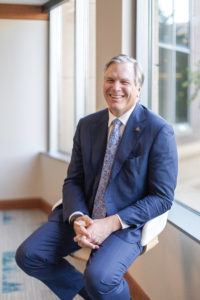
Fall 2018 Update from Bret Weiss

Bret Weiss, President/CEO, WSB

Fall is here which means the Minnesota golf season is ending and winter is on its way. I am not a winter sport guy, so this season gives me a chance to evaluate our year and start planning for 2019 and the new services and markets that we are going to pursue. This has been a challenging year on many levels. Choosing to grow, expand, and improve does not happen easily and yet it’s necessary to the sustainability of any organization.

We continue to mourn the loss of Vern Hedquist, a valued staff member who was killed earlier this fall on a job site. We know that this loss is much more difficult for his wife, Cindy, and his family. Finding solutions to design and manage projects while facing the reality of construction zone dangers with the increasing number of inattentive drivers is never far from our minds. We have been buoyed by the kind support from you and all our friends in the industry. Thank you for showing how much you care. My coach Lou Holtz always said, “People want to know that you care.” That care came through in a very strong way. One of the things that we know all too well is that life doesn’t stop for anyone.

In October we celebrated our 23rd anniversary and have accomplished a lot this year thanks to our clients. It is so helpful to have clients that are willing to partner with us to find new ways to deliver solutions. We have a strong entrepreneurial culture which fuels our passion for innovation and curiosity. We have developed new software applications that are being used by real estate and alternative energy developers throughout the country. Our pipeline group now reaches across the country and continues to grow and develop. We hope it’s clear that we never shy away from trying something new and we don’t back down from a challenge. Please continue to challenge us.

We recently rebranded. We know that changing a logo or mark doesn’t inherently change a company. In our case, we were searching to align who we are as a company with our mark and messaging. We are a bold company with a vision to find ways to improve our industry. This is expressed with passion and energy and for the sake of our staff, we needed a change. Who we are has not changed, but how we express it has. We will continue to improve our processes, quality, and solutions as we move into 2019.

I want to share one final quote that I love, and typifies our staff at WSB. “It is not simply the brightest who have the best ideas; it is those who are the best at harvesting them from others. It is not only the most determined who drive change; it is those who most fully engage with like-minded people. And it is not wealth or prestige that best motivates people; It is respect and help from your peers.” – Alex “Sandy” Pentland, Director of MIT’s Human Dynamics Laboratory

Thanks for continuing to inspire us every day.

Bret Weiss, President/CEO

Over, Under, Through, Across: A Right of Way Rule of Thumb

Faye Gillespie, Right-of-Way Specialist, WSB

Ensuring we have the necessary land rights is the first step that we take on all public and private projects. A simple way to determine if you need to consult the Right of Way Department for a new project is to ask the following question:

Does the project or the people who will be working on it have to go over, under, through, or across any land that is not currently owned by your client either temporarily or permanently?

Over: The Right of Way Department often must acquire land for overhead easements and projects that include things like telephone lines, electrical transmission or distribution lines, and other utilities. You may not install anything overhead that crosses private property without an easement providing the right to do so.

Under: Sewer lines, along with various other utilities, are often installed under someone’s land. Whether you need to dig up or directionally bore under private property, installing something under the land requires that rights must be acquired from the property owner.

Through: Any project requiring any access to travel through – or work in/on – any private property requires land rights.

Across: Anything installed across private property, either permanently or temporarily, also requires the right of way process be followed. Sidewalks, trails, roads, and light rail are all great examples of projects that may go across private property.

The Right of Way Department needs to be involved as early as possible on any project that must go over, under, through, or across private land. We follow all federal and state processes when acquiring land for projects. This process can be complicated and take time, but it is critical that we abide by and comply with the law.

Additionally, if federal funding is involved with any aspect of the project, we must act in accordance with the Uniform Act when purchasing land rights from property owners. Not following that process could risk federal funding being rescinded.

Stepping onto private property at any time without the appropriate rights to do so – even temporarily – leaves clients open to both legal and civil consequences.

We provide our clients with the technical excellence and quality projects they deserve. In the Right of Way Department, we are also indebted to our landowners. We must treat landowners fairly and lawfully, and always provide them with just compensation for the land rights our clients need. To maintain this standard of excellence, we always apply the Over, Under, Through, Across rule to all projects from the very beginning.

Parks, Open Space, and Trail System Planning

by Candace Amberg
Feb. 6, 2015

Quality of life in any community is dependent on that community’s character, physical environment, and personal living space. These can all be improved when a community includes parks, natural open spaces, trails, and recreational opportunities.
The most successful approach to developing a park system plan – or any comprehensive planning project – is through a robust public engagement process. This will achieve the best understanding of constituent needs, resulting in local confidence that planning decisions align with and are relevant to the interests of the population being served. It is particularly important to engage the public when considering a referendum. The graphic below illustrations how a public engagement process can avoid wasted resources or community dissatisfaction.

Modern park system planning should be based on the specific needs of the community and citizens that the parks will serve. The process of developing and maintaining public space is costly and time intensive, and should be conducted through a thorough and transparent needs assessment and public process. This routinely involves hosting several input and review meetings with a wide variety of individuals, committees and stakeholders. Digital communications, social media, and other survey techniques may be effective ways to reach the right audiences.

The goal is ultimately to ensure that the findings and recommendations are a synthesis of the input from the residents, elected officials, city staff, and other community members. Following is a partial list of considerations that are typically explored when considering long-term improvements to a community’s park system.

• History of the system
• Previous planning studies and reports
• Demographics
• Recreation trends
• System-wide property and facility assessment
• Public input/needs and desires of the community
• Active/programmed recreation, as well as passive uses
• Community image, tourism, and economic development
• Trail network – internal and external connections
• Natural resource management
• Budget
• Safety and accessibility
• Flexibility of spaces to create a variety of experiences
• Operations and maintenance

Planning and the “Smart City”

By Karina Martin
March 4, 2016

What is a Smart City?

Monumental advances in technology and data management over the past two decades coupled with a global increase in the urban area population have paved the way for integrating more technological networks into the built environment and public engagement processes. There is a demand for increased public accountability, constant access to real-time data, and a growing awareness of the need to develop cleaner and more cost-effective infrastructure systems. A Smart City systematically incorporates data and technology into existing frameworks to efficiently operate local systems, reduce costs, enhance quality of life, and invite more sharing of ideas.

Why a Smart City initiative?

Planners will play an important role in the future of Smart City development and are already facing important questions related to technology deployment, data collection, and overcoming technology access and equity concerns. The American Planning Association (APA) developed its Smart Cities and Sustainability Initiative to affirm the relevance of Smart City technology to the field of planning and to identify what critical technologies planners will need to pay attention to in the decades to come. The main goal was to gauge the knowledge and interest level of planning professionals in different aspects of Smart Cities and to make recommendations about how to support the interests of planning professionals going forward.

Overview of Smart Cities components

The concept of Smart Cities can seem intangible. The Smart Cities and Sustainability Initiative report gives a broad overview of the key components of Smart Cities and provides a framework for understanding and tying the concept to the planning profession.

Broadband network expansion – High-speed broadband networks will become a staple of Smart City technology. The definition of “high-speed” is continuously changing, and the demand for streaming services and cloud computing are pushing the limits of what is considered fast and reliable access. The FCC National Broadband Plan has a goal of delivering 100 mbps broadband to anchor public institutions like libraries, schools, and government centers by 2020.

Smart Cities will need to balance investments in both broadband and wireless network access to meet the needs of a diverse customer base.

Technology and data applications – Smart Cities require incorporating more data into existing systems. Smart Cities put data to greater use, which requires enhanced points of data collection integrated into infrastructure. The Smart City is adept at “collecting, communicating and crunching” data (Smart Cities and Sustainability Initiative, page 12), as well as using data to optimize systems and anticipating problems before they occur.

Sustainability, resiliency and energy – Much optimism surrounds the idea of using Smart City technologies to improve the energy efficiency of local and regional systems. Deploying “smart grids” will allow for automated and adaptable energy delivery systems. Green building technologies will help improve the energy efficiency of buildings, the single-largest carbon emissions source in the world. Planners can influence code and ordinance development to help usher in these changes in the built environment.

Equity and the digital divide – While Smart City technology has the potential to be transformative, the increasing role of technological services raises the important question of access and equity. The potential exists for certain populations to be systematically excluded or underserved by Smart City technology, including seniors, low-income families, minority households, and individuals without a college education (Smart Cities and Sustainability Initiative, page 14).

Governance and the planner’s role – Smart Cities implies an increasing reliance upon technological applications for public feedback and engagement. The hope is that increasing the access points for public engagement through technology will reach more people than traditional methods. Planners will need to use this technology in a transparent fashion and ensure that public trust is maintained.

Findings of the Smart City initiative: What is of most interest to planners?

The APA Smart Cities Initiative Task Force incorporated a listening phase, which directed outreach to APA members through a survey including 14 different Smart City topics, asking participants to rank the importance of these topics, their interest and their desire to learn more about each topic. The listening phase also included an ideation tool online forum, and an innovation portal hosted by an APA-based LinkedIn portal.

Green building and site design, socio-economic disparity, and renewable energy and efficiency were ranked as the top three areas of importance by survey respondents. Public safety and freight supply were ranked as the least important. Interestingly, public safety also ranked as the subject area that most planners want to learn more about. The full list of topics and the results matrix is included here:

Photo Credit: Appendix (page 30) of APA’s Smart Cities and Sustainability Initiative report

Moving forward

The report concludes by observing that planners have an interest in Smart Cities, and recommends that APA develop strategic actions, including:

  • Centralize innovative information surrounding Smart Cities for use by planning professionals
  • Develop comprehensive plan Smart City guidelines
  • Partner with research entities to increase the body of knowledge on Smart City technologies
  • Utilize APA’s National Planning Conference as an opportunity to teach about technology
  • Work with AICP to train planners on integrating technology systems
  • Create a divisions council initiative for Smart Cities
  • Offer ethics training related to big data
  • Advocate for policies that bridge the digital divide

Preparing for the Unknown – Civil Engineers and Climate Change

by Brandon Movall
Jul. 6, 2017

Evidence strongly suggests that our climate is changing and will continue to change. Since the role of civil engineers is to plan, design, construct, operate, and maintain the world’s infrastructure far into the future, climate change – and the events associated with it – must be accounted for in all parts of a project.

Former American Society of Civil Engineers President H.G. Schwartz said, “If you think about all these extreme events – flooding, precipitation, drought, fires, etc. – they affect the built infrastructure and that is what we as civil engineers do; we design and build the infrastructure. Civil engineers need to know that [climate change] is an important factor as we develop infrastructure systems – be they highways and bridges, water or wastewater plants, power lines and transmission line [or] buildings, ports, [and] harbors. Almost everything we touch can be impacted by these [extreme] events. And then [we] need to ask: what are we going to do about it?” (Scott 2014).

In the Midwest, accelerated temperature rises, increased precipitation, and larger and more frequent floods have already made headlines around the region. These types of events have a direct impact on our cities and infrastructure.

Annual average temperatures have increased three times more rapidly over the last 20 years compared to the last 100 and are projected to increase more rapidly in the future. Civil engineers must try to predict new temperature highs and lows to create roads that will be able to handle more significant temperature changes. In addition, we must also create infrastructure that limits the reflection of heat waves back into the general population to decrease the number of heat-related mortalities. This can be achieved by using different materials, lighter colors, or designing around the pattern of the sun.

Overall precipitation has increased in the Midwest, by up to four inches per year in some areas. Designing and updating storm sewer systems to handle increased levels of rainwater is one of the main focuses for civil engineers today.

Finally, floods have also increased in size and duration over the last 50 years, causing billions of dollars in damage and often loss of life. We must plan for more intense flooding by strengthening existing infrastructure and considering how urbanization of the Midwest impacts our wetlands.

While these events are real and can sound troubling, civil engineers are focused on preparing for them and other unknowns that may be the result of climate change. Updating our infrastructure in smart and sustainable ways will ensure society is prepared for the future.


Sources:

Abraham, John, “Global climate projects help civil engineers plan,” The Guardian, May 27, 2017. https://www.theguardian.com/environment/climate-consensus-97-per-cent/2017/may/25/global-climate-projections-help-civil-engineers-plan

Scott, Doug, “Civil Engineers Have A Key Role to Play in Adaptation to Climate Change,” ASCE News, May 12, 2014. http://news.asce.org/civil-engineers-have-a-key-role-to-play-in-adaptation-to-climate-change/

Slater, Louise J. and Gabriele Villarini. “Recent trends in U.S. flood risk” Geophysical Research Letters 43, no. 24 (December 28, 2016): 12,428-36. doi: 10.1002/2016GL071199.

Melillo, Jerry M., Terese (T.C.) Richmond, and Gary W. Yohe, Eds., 2014: “Climate Change Impacts in the United States: The Third National Climate Assessment.” U.S. Global Change Research Program, 841 pp. doi:10.7930/J0Z31WJ2.

Mallakpour, Iman and Gabriele Villarini, “The changing nature of flooding across the central United States” Nature Climate Change 5 (February 9, 2015): 250-254. doi:10.1038/nclimate2516.

The National Academies of Sciences, Engineering, Medicine “Climate Change Will Have a Significant Impact on Transportation Infrastructure and Operations; Research, Tools, Action Needed to Pinpoint Vulnerabilities” March 11, 2008. http://www8.nationalacademies.org/onpinews/newsitem.aspx?RecordID=12179

Stormwater Management: Protecting the water in Minnesota’s 10,000 lakes

Laura Rescorla, Graduate Engineer, WSB

What is stormwater?

Stormwater is the water that flows over the ground after rain and snowmelt events. It runs off buildings, streets, sidewalks, and parking lots – anywhere it is prevented from naturally soaking into the ground.

Stormwater can pick up debris, chemicals and dirt before it reaches its final destination. If not managed properly, stormwater can also contaminate streams, rivers and lakes; destroy aquatic habitats and kill aquatic plants, fish and animals; or even contaminate drinking water if it is polluted.

What can you do to prevent contamination?

Start implementing these practices today to protect our water and encourage your neighbors to do the same!

  • Use pesticides and fertilizers sparingly.
  • Properly dispose of products such as insecticides, pesticides, paints, and used motor oil. Do not pour these chemicals – or any other household products – into storm drains or onto the ground.
  • Sweep up litter and debris from sidewalks, driveways, and parking lots – especially around storm drains. Do not put anything into storm drains.
  • Clean up pet waste and dispose of it properly.
  • Don’t overwater your lawn.
  • Use a rain barrel or plant a rain garden.
  • Go to a car wash or wash your car on your lawn so that the water infiltrates into the ground.

 Sources

Image sources

Summary of 10 States Standards for Drinking Water Distribution Piping Design

by Erin Heydinger
April 6, 2017

The Great Lakes-Upper Mississippi River Board develops recommended standards for water works. These standards are followed by regulatory agencies in Minnesota and are used for the design of water systems.

Below is a summary of system design standards for distribution system piping and appurtenances:

Pressure:

  • The system should maintain a pressure of 20 psi at all points under all flow conditions.
  • Normal working pressure should be 60 to 80 psi, and no less than 35 psi.

Diameter:

  • Water mains that provide fire protection should be at least eight inches (8″) in diameter.
  • Water mains that do not provide fire protection should be at least three inches (3″) in diameter.

Fire protection:

  • Systems should be designed in accordance with State Insurance Office fire requirements.

Dead ends:

  • Dead ends should be minimized to reduce stagnant water, provide reliable service, and reduce head loss.
  • Dead ends should be equipped with a way to provide flushing at a rate of at least 2.5 feet per second in the pipe being flushed.

For the full set of the standards, click here.

Light Detection and Ranging (LiDAR) Elevation Data

Bryan Pittman, Sr. GIS Specialist, WSB

What is LiDAR?

LiDAR, which stands for Light Detection and Ranging, is a combination of “light” and “radar.” It’s a remote sensing technology that uses lasers to detect and measure features on the surface of the Earth. Due to its high accuracy, LiDAR has become the de facto standard for creating elevation surfaces and measuring heights of features above the ground such as trees or buildings.

LiDAR in action

Minnesota completed a statewide LiDAR gathering project funded by the Clean Water, Land and Legacy Amendment, and spearheaded by the Minnesota Department of Natural Resources and the Minnesota Geospatial Information Office. The six-year project resulted in a seamless, high-resolution digital elevation map of the entire State of Minnesota. This data is completely free to download and offers a vertical accuracy of six inches. This project has enabled the flow of accurate topographic information between all organizations and the general public.

LiDAR deliverables

The deliverables of the project came in different formats. The simplest and most frequently used format is two-foot contours that were generated statewide. There is also a high-resolution Digital Elevation Model (DEM) that can be acquired as county tiles. The user can generate contours at varying intervals in this format, such as one-foot or even six-inch. Both the contours and the DEM use bare earth returns, meaning you only get surface elevation.

A third format is the raw LiDAR data, which is dense collection of points, or a point cloud. If you imagine the laser from an airplane hitting the surface, it’s the information at that contact point that is reflected back to sensors on the plane. The density of those points depends on the exact collection methods, but typically there will be 2 million points per square mile, or approximately 20,000 points for a typical city block. The point cloud gives access to all the returns and not just the bare earth returns; therefore, we can gather information about the heights of trees, buildings, water towers, etc. The point cloud is so dense that it is even possible to extract overhead power lines from the data. These multiple returns allow the data to be used for many different 3D analyses and visualizations. Certain 3D software packages allow the user to take the point cloud and turn it on its side, creating a vertical profile with accurate object heights and ground elevations.

LiDAR uses

There are many uses for LiDAR data beyond viewing ground elevation or object heights. Any kind of hydrologic flow analysis can benefit from the use of this data. Erosion analysis can be done by using slope estimates from LiDAR to compute the amount of erosion in certain areas, and that in turn can be used to calculate sediment accumulations. LiDAR has also been used for flood modeling, urban planning, oil and gas exploration, and coastline management. With the wide availability of free and highly accurate topographic data, many are reaping the benefits of LiDAR data and finding that its uses are far-reaching across many disciplines.

An overview of wetland/water permitting in Minnesota

Alison Harwood, Director of Natural Resources, WSB

Wetlands and other waters in Minnesota are regulated by a variety of agencies, including those at the federal, state, local or watershed level. Knowing who to contact and what type of approvals are needed is important and depends on the scope and location of the project.

Federal level

At the federal level, the U.S. Army Corps of Engineers (COE) regulates discharge of fill to waters of the U.S. and works within the channel of navigable waters as defined by Section 10 of the Rivers and Harbors Act. If work is proposed within a water of the U.S., a permit may be required through Section 404 of the Clean Water Act. Project impacts will fall into one of the following permit categories:

  • Regional General Permit (GP): These permits are issued for projects that impact less than 0.5 acres of wetland and authorize a specific list of impacts, or authorize work that is regulated and approved by the Minnesota Department of Natural Resources (DNR) through the Public Waters program. It typically takes three to four months to obtain this permit. In Minnesota, approval with a GP automatically includes EPA/MPCA Section 401 Certification.
  • Letter of Permission (LOP): These permits are issued for projects that impact wetlands between 0.5 to three acres (non-road projects) or 0.5 to five acres (road projects). COE performs an environmental assessment, taking four to 12 months to obtain this permit. In Minnesota, this approval automatically includes EPA/MPCA Section 401 Certification.
  • Individual Permit (IP): These permits are issued for projects that exceed the thresholds for the GP and LOP. COE performs an environmental assessment, taking anywhere from nine months to two years to obtain this permit. EPA/MPCA Section 401 Certification must be obtained separately.

State level

At the state level, the DNR regulates areas below the Ordinary High Water (OHW) of wetlands and waters listed as Public Waters. (View maps of DNR Public Waters. Obtain the OHW elevation from the DNR Area Hydrologist.)

If work is proposed below the OHW of a public water, a Public Waters Work permit will be required, which typically takes 60 to 90 days to obtain. It can take longer to obtain the permit depending on the complexity of the project. The DNR also issues permits for other types of work within public waters, including docks, crossings, dewatering, dredging, and boat launches.

Local level

At the local level, the State of Minnesota issued MN Rule 8420, the Wetland Conservation Act (WCA). (Guidance can be found here.)

The objective of the WCA is to obtain no net loss of wetlands within the state. The rule is administered at the local level by a local government unit (e.g., the city, county, watershed district, or soil and water conservation district.

If a project will impact a wetland, an approval through the Wetland Conservation Act is likely necessary. There are several types of approvals that may apply to the project:

  • No loss: Indicates that the wetland will not be impacted by the project (e.g., temporary impacts, impacts to incidental wetland).
  • Exemptions: Various exemptions exist for projects that are required to maintain public health and safety but also may result in minor wetland impacts.
  • De minimis: Allows a minimal amount of wetland impact to occur depending on the location of the wetland impact within the state.
  • Replacement plan: Allows wetland impacts to occur given that no other alternatives exist, impacts have been minimized to the extent practicable, and impacts will be mitigated (e.g., replaced).
  • Road bank replacement: Allows the state to replace for impacts to wetlands required due to the reconstruction of an existing serviceable public roadway to meet safety or design standards. This program is available to city, county, township, and other local road authorities. It is not available for Minnesota Department of Transportation projects.

To obtain any of the above permits, an applicant must provide project information that includes a project purpose and need, alternatives analysis, impact minimization measures, and a mitigation plan. Typically, mitigation is required at between a 1:1 to 2.5: 1 ratio.

Some watershed districts within the state also have regulatory authority over the waters within their watershed. Though each watershed district has their own specific rules, they typically cover impacts resulting from stormwater, erosion, dredging, wetland impacts, and floodplain fill. (Determine which watershed district a project is located within.)

What does this mean for a project?

If a project has the potential for water resource impacts, it is best to start coordinating with the applicable regulatory agencies as soon as possible (ideally a year in advance of construction). If you are unsure of whether your project will impact wetlands, begin by contacting your local WCA representative, Army Corps of Engineers regulatory department, and/or DNR Area Hydrologist.

WSB Redefined

Forging ahead with a new brand.

We’re excited to officially launch the new branding of WSB. Sure, there’s a new logo, but it’s much more than that.  It represents the sum of all things WSB – our work, our people, our process – as well as how we look and sound.

Since 1995, we’ve dedicated ourselves to the value of strong relationships, collaboration and forward-thinking ideas. We’ve inspired each other and been inspired by our clients to discover thoughtful and creative solutions that look beyond the needs of today to the opportunities of tomorrow. This rebranding is not a change in direction, but rather, an attempt to better define who we’ve always been and where we’re headed.

As we reflect on our past and anticipate our future, we’re thankful for our partners who have shared in our vision, passion and commitment.

Here’s to the future as we forge ahead together.