Water

MDH Lead Service Line Inventory Regulations – What Communities Need to Know

April 17, 2023
By Jerry Schimmel, Project Engineer, WSB

In 2022, the Environmental Protection Agency (EPA) announced new rules that require the removal of service pipes in cities nationwide that contain lead and copper. Lead pipes, primarily used in infrastructure through the first half of the twentieth century, can have negative long-term impacts on human health and water quality. This new rule will help communities support sustainable water infrastructure that provides safe drinking water to all Americans.

State regulatory agencies are tasked with enforcing and administering funds for this initiative. In Minnesota, the Minnesota Department of Health (MDH) is the managing agency. This is a significant undertaking for many cities, and it is important that municipalities understand how to navigate and comply with the new rules. 

What do cities need to know to ensure compliance with this new regulation? Here are three things to consider.

There will be funding to help cities comply with these new mandates. While updating water infrastructure and removing lead pipes can be an expensive task, cities have the opportunity to access grants to help fund this process. The federal Infrastructure Investment and Jobs Act passed in 2022 set aside dollars for cities to help support service line updates. Grant funding can also be flexible to meet community needs, from paying for community awareness campaigns to self-testing lines to taking lead pipe inventory and more.

Cities must inventory their pipelines by 2024. By October 2024, all cities must complete the inventory of all service pipes in their community. This means cities need to act now. Meeting this deadline requires a multi-pronged approach that includes mapping out all the service lines in a city, determining which contains lead, and finally creating and implementing a plan for the removal and replacement of the lead pipes.  

Data is key, and that means educating and working with residents. Mapping pipeline data is a big undertaking for many communities, especially as many cities will need to go beyond historical records to map out their service lines, that’s why resident participation is important. Communities should leverage GIS data to help build and map which service lines are at risk of having lead components. Online mapping tools and tips can help residents identify lead service lines and report back to the city. The more user-friendly testing and data collection is, the more accessible it is for the public.

What’s more, because water quality issues more commonly impact disadvantaged and low-income communities, 49% of program funds are directed toward traditionally underserved communities to improve drinking water quality. Educating and engaging with these neighborhoods and residents will be important for cities, and the focus should be on raising awareness and helping with testing.

WSB offers all the services for cities to navigate and implement the new regulations, including grant proposals, inventory, mapping, and identification. We assist cities throughout every step of the process, including:

  • Establishing a database that meets the MDH reporting requirements
  • Creating and implementing a public engagement plan to educate and build community awareness
  • Gathering and tracking data by leveraging Esri Lead Service Line Inventory software
  • Planning and implementing a lead pipe replacement program
  • Building a comprehensive report documenting the lead resolution to MDH by October 2024
  • Identifying and applying for grants to support community compliance and pipeline updates

    Service pipelines supply drinking water to homes, businesses, and schools. Safe drinking water and sustainable infrastructure are critical to healthy communities, and while this new rule will be a significant undertaking, it also provides meaningful opportunities for communities to make much-needed improvements.

    Jerry is a project engineer and manager delivering complex projects in municipalities, small and large. He has a breadth of knowledge and understanding of full reconstruction projects, and can identify and solve risks and problems throughout the design process, delivering projects on time and on budget.

    [email protected] | 612.409.1014

    Paving the Way: Four Proactive Trail Maintenance Tips for Communities

    April 17, 2023
    By Jordan Gedrose, Landscape Architect, WSB

    As Spring emerges, trail use will be in full swing with joggers, walkers, and bikers. When looking at the types of recreational trails, such as gravel, concrete, and bituminous, bituminous is the most common type of trail. Bituminous, also known as asphalt trails, are used in high pedestrian trafficked areas and are often the more cost-effective trail option.

    Trail maintenance is essential for trail user safety, accessibility, and trail preservation. It means creating equitable communities where all residents have access to similar-quality trails and outdoor amenities.

    Here are four trail maintenance tips for communities, especially after a winter of record snowfall.

    1. Seasonal Trail Inspections

    Municipalities must inspect trails during each seasonal transition. Each part of the year brings new weather that can impact the usability of a trail, and as temperatures warm up and snow melts, cities need to inspect trails to be ready for increased traffic. Identifying pavement cracking, chipping, and heaving are part of the visual inspection. Trails receiving routine pavement inspections and maintenance will save communities money in the long run instead of allowing trail issues to worsen over time resulting in more costly repairs in the future.

    1. Repair and Preventative Measures

    There are many different reasons for trail pavement failure. These include environmental factors, such as sunlight, oxidation, water, the freeze/thaw cycle, aging, and vegetation. Traffic usage from maintenance equipment, utility vehicles, and pedestrians also contributes to trail failure.

    There are several different options for preventative and minor rehabilitation practices that significantly increase the overall lifespan of a trail. Generally, applying a trail sealant every four years after the trail is constructed is ideal.

    1. Remove Debris

    A build-up of debris on the pavement occurs during the winter when usage is low—blowing and sweeping trails in the spring is essential to clear them. It can involve removing fallen trees and branches or trimming overgrown vegetation. Snowmelt can bring additional leaf litter and soil onto the trail, so be sure to identify any areas near the trail that are eroding to protect the structural integrity of the trail as well as limit the amount of debris getting on the trail. Check catch basins to ensure no debris obstructs the inlets to ensure water is not getting trapped on the trail.  

    1. Update Trail Markings & Infrastructure

    For the same reasons pavement may need repairs based on environmental, usage, and design, pavement markings such as walk and bike lanes, direction symbols, or trail instructions should be upkept and repainted as needed. This includes signage as well. This is critical for user safety. 

    In addition to trail maintenance procedures,  infrastructure such as pet relief stations, bike repair tools and pumps, benches, garbage receptacles and lighting should be operational and ready to use. 

    How WSB Can Help?

    WSB can help create a customized trail maintenance plan that meets your community’s needs. We also design, construct trails, and help communities implement preventative maintenance to ensure residents get the most out of local trails.

    Jordan is a landscape architect who has worked with many communities to deliver visionary and achievable park master plan projects. He brings his conceptual, graphical, and technical expertise to projects including streetscapes, park and trail planning, playground design, and athletic complexes. Jordan is committed to collaborating with the client and providing thoughtful design input to create unique outdoor spaces and experiences.

    [email protected] | 612.263.0687

    Designing Drainage Systems for Renewable Energy Sites

    By Dan Cazanacli, Project Manager, and Henry Meeker, Graduate Engineer, WSB

    When designing drainage systems for renewable energy sites, many different surface water factors must be considered to ensure a well-constructed system. These factors include how floods can impact the site, how water damage affects equipment and access points, soil erosion, water regulations, and how runoff impacts the surrounding ecosystem.

    Floods can cause both widespread and deep channelized flow across solar farms.

    Designers need to understand how water will flow across the site in different flood scenarios. Many renewable energy sites are located near floodplains, which can make the design process even more complicated. To tackle these challenges, WSB engineers use sophisticated 2D hydraulic models to map the direction, depth, and speed of water flow across the site.

    Stop water damage to critical site components.

    A crucial part of the drainage systems design process is ensuring that water, in any scenario, can flow smoothly across the site without causing any damage or flooding to critical components, such as inverters or battery storage units. Designers use the results of the hydraulic models to find the best solutions for water flow and to place these critical components away from the main flow of water. The models are also used to identify areas where water flows too quickly. WSB develops erosion control measures in these situations, such as reinforcing road surfaces at low water crossings.

    Plan for ground erosion around solar panel support piles.

    Another important aspect of renewable energy site design is ensuring that the supports for the solar panels can withstand strong winds and flooding. Each site is unique, our engineers work closely with our clients to use the results of the hydraulic models to assess the potential scour depth, meaning the point in the ground where erosion could occur, around the support piles and identify the appropriate methodology to use. This determines the best depth for embedding them. The models can also be used to identify areas where water is flowing too quickly and to develop erosion control measures, such as rock stabilization.

    Consider water quality and management regulations.

    Designers also need to consider regulations around stormwater management, water quality, floodplains, wetlands, and critical species/habitats. Project timelines will be significantly delayed without proper planning and consideration of these factors. WSB works to minimize the impact of the site on these sensitive areas while ensuring that the project proceeds on schedule. This often involves working closely with local government units and obtaining the necessary permits.

    Protect ecosystem health.

    Designers must understand how solar panels interact with the surrounding vegetation and soil. Major institutions, like the University of Minnesota, are performing ongoing research into how panel runoff affects water infiltration and an ecosystem’s health that will be incorporated into designs. Designers can leverage these findings to optimize water quality benefits for the site, incorporating water quality basins, pollinator-friendly vegetation, and site-specific erosion control measures.

    How WSB Can Help

    Do you need help planning your solar project and navigating challenges around drainage water systems? WSB can help with your design, develop erosion control models, ensure protection of local ecosystems through sustainable solutions, and more.

    Dan has 15 years of experience in water resources and geotechnical engineering in the private sector. Dan is now a project manager for WSB, and provides value to projects through his extensive background in hydrology and hydraulics, fluid mechanics, geomorphology, geology, soil mechanics, and groundwater flow.
    [email protected] | 612.201.0184

    As a water resources graduate engineer with WSB, Henry works on a variety of stormwater management projects. His work on regional stormwater systems, roadway improvement projects, and stormwater treatment retrofits benefited from his technical knowledge which includes utility-scale solar drainage, hydrologic and hydraulic modeling, water quality modeling, floodplain modeling, best management practice design, watershed permitting, and stormwater conveyance systems.
    [email protected] | 612.258.8157

    Housing, house

    How Smart Cities Can Help Leaders Rethink Housing

    March 13, 2023
    Lori Johnson, Sr Professional Community Planner, WSB

    From phone apps for garage doors and heating systems to new security tools like Ring doorbells, we use technology in our homes to make our lives easier. Now cities are also using technology in housing decisions to make the lives of residents better and improve their communities.

    Smart city tools and data are key when cities think about housing, including when it comes to making constructive decisions, building homes, and identifying the greatest needs for community housing. 

    Here are some ways cities are getting smart about housing. 

    A Different Approach to Building Permits 

    Until recently, builders were sending in paper copies of everything they needed to obtain building permits. Architectural plans and site plans were required, and they often came into building departments on large paper rolls. Inspectors and planners were using paper plans to review for code compliance and very often had to move these large plans from office to office. Now, technology is making this process smarter, more accessible, more efficient, and eco-friendly. 

    There are several tech applications that cities can take advantage of for building permit issuance such as iMS and eTRAKiT. All building permits can be issued online, and everything is submitted and paid for electronically. The automation and productivity of issuing online building permits makes it faster and easier for builders to get started on homes – saving time and money.

    Data-Driven Decision Making

    With the use of online applications for building permit issuance, it also allows cities to collect information to make data-driven decisions. This means having access to information on home prices, location, types of construction, etc. 

    Additionally, this data can be mapped to see where there are deficiencies in certain types of housing and resources. From that, communities can identify where there is a need for additional affordable housing, what types of housing are needed in different neighborhoods or regions, and make future investment and resource allocation decisions. Moreover, as affordable housing is a need in most communities, smart tools and data are essential to help resolve critical shortages. 

    It’s not just city leaders that benefit from smart tools, but residents too. Technology allows homeowners and buyers to easily research addresses for past building permits, so they know what has been done to their home and when. There are also advantages when it comes to shopping for mortgages, allowing consumers to make educated purchase and remodeling decisions. 

    The Building Process in 3D

    Smart technologies are also affecting the way new homes are constructed. Some modular home builders use 3D modeling to generate home plans. Builders can then create modular homes in temperature-controlled environments at a faster pace than regular home construction and with less physical labor. It also helps eliminate barriers like being able to build in snowy, cold climates for instance. This is making home building more affordable and efficient. 

    For city planners, the use of 3D modeling also comes into play when envisioning new housing types within communities. When planners are able to virtually see what the built environment will look like, they can make better recommendations to the community.

    Looking Toward the Future

    Integrating smart tools and tech into community building and planning allows cities to make smarter decisions. It can help identify and solve problems, tackle affordable housing shortages, and make processes more efficient and effective for builders and residents alike. 

    It is important to remember that the term “smart cities” does not always mean that all citizens need to use technology to make their built environments better. But it does mean that it helps decision makers make smart decisions and smarter cities. WSB has many ideas and resources available to help cities be a part of this smart city evolution. If you have questions, we are always here to help you plan for and implement smart city technologies.

    Lori has more than 25 years of experience working in a municipal planning department, having worked her way up through the planning department at the City of Blaine to become their city planner. She has worked in all aspects of city planning activities including project management, site plan and application review, public participation and long range planning.

    [email protected] | 612.364.3029

    How the Climate Pollution Reduction Grant Can Help States, Cities, Municipalities, and Tribes

    March 13, 2023
    Andi Moffat, VP of Environmental Services, WSB

    Major infrastructure and spending packages passed in the last year by the federal government, including the Inflation Reduction Act (IRA) and Infrastructure Investment and Jobs Act (IIJA), are assisting communities across the country build a more sustainable, equitable and environmentally friendly future. There is a significant influx of dollars going into communities across the nation, and now is the time to ensure you do not miss out on these meaningful funding opportunities. 

    Recently, the Environmental Protection Agency (EPA) announced eligibility requirements for its Climate Pollution Reduction Grant, and here is what community and tribal leaders should know about this grant program. 

    The Climate Pollution Reduction Grant

    The new Climate Pollution Reduction grant consists of $5 billion in funds and is broken up into two different phases. 

    The first phase is a non-competitive planning phase where $250 million in grants will be made available to qualifying communities. This phase is all about collaborating across government entities, assessing greenhouse gas emissions, and climate planning.

    • States must submit a Notice of Intent to Participate to the EPA by March 31, 2023. The funding that State’s receive may be available for cities within those states for additional planning funding. Please watch for updates from your local State Pollution Control Agency. 
    • Cities within Metropolitan Statistical Areas (MSA’s) designated in the grant guidance may also be eligible when coordinating across the MSA. The lead entity for the MSA will need to submit a Notice of Intent to Participate for grants by April 28, 2023.
    • Tribal communities must coordinate with their EPA Regional Office soon to indicate interest in this funding.

    While this is a non-competitive grant, an application is required. States must submit the application by April 28, 2023. MSA’s must submit the application by May 31, 2023. Tribal Nations must submit the application by June 15, 2023.

    The second phase of the grants will have $4.6 billion available for project implementation for the year 2024 and beyond. It is important to note that to qualify for the second phase grants, communities must have received or been covered by the first phase planning grant either directly from the EPA or covered by your State grant. Applicants must have a System for Award Management (SAM) number and be registered in Grants.gov to apply for the grants. 

    Funding Opportunities 

    City planners, sustainability coordinators and local leaders can support a wide variety of planning and implementation projects with this grant funding. Projects can fall under a number of categories including transportation systems, reducing greenhouse gas emissions, natural and working lands, resilient communities, and clean energy. 

    Additionally, each project must have a diversity, equity and inclusion connection, so it’s critical that applicants carefully consider and understand how these projects impact BIPOC and low-income communities, improve underserved neighborhoods, or incorporate an environmental justice lens in the project. 

    What To Do Right Now

    This is a substantial and historic funding opportunity for communities and tribes, so be sure to submit a notice of intent by March 31 if a State, by April 28, 2023 if a large MSA, or to start coordination with your regional EPA Office if a Tribal Nation. Also check with your state Pollution Control Agency or equivalent as states will also receive funding.

    If you are unsure where to start or how best to approach next stems, WSB is available for consultation, grant writing, and more. We can help partner with you to advance meaningful infrastructure and environmental improvement projects in your community. 

    Andi is a Vice President with more than 23 years of experience leading people and projects that include planning, environmental, energy, highway, natural resources, construction and development. She oversees our Environmental services and approaches her work with passion and positivity.

    [email protected]m | 763.287.7196

    Protecting the Endangered Northern Long-Eared Bat: What It Could Mean for Your Project

    March 13, 2023
    By Lucas Wandrie, Sr Wildlife Ecologist, WSB

    Northern long-eared bats are suffering significant population declines due to a number of factors including white-nose syndrome and summer and winter habitat loss. As a result, the U.S. Fish and Wildlife Service (USFWS) recently changed the status of the northern long-eared bat from federally threatened to endangered. The change will go into effect on March 31, 2023. Projects that may impact individual northern long-eared bats or their habitat will no longer be protected under the 4(d) Rule. These impacts include tree removal and collisions with wind turbines.

    The full extent of how this new endangered designation will affect project schedules or project feasibility is still unknown. However, before the status change takes effect and the USFWS releases the new northern long-eared bat determination key, there are some key items to consider. 

    What projects will be affected?

    This change will apply to all projects within the northern long-eared bat’s range. If your project received a “No Effect” or “Not Likely to Affect” determination from the USFWS, it is still valid under the new restrictions. However, if your project received a “Likely to Adversely Affect” determination, coordination with the USFWS will have to be re-initiated. 

    Suitable habitat of the northern long-eared bat includes trees that have cavities, sloughing bark, and deep crevices. Additionally, trees that are three inches or more in diameter at approximately chest height are potentially suitable habitats. Furthermore, individual trees can be considered suitable habitat if they are within 1000 feet of another suitable habitat. Understanding the habitat suitability of your project area is essential to follow USFWS guidelines and to avoid and minimize the risk of northern long-eared bat take.

    So, what does this mean for my project?

    The new implications of the status change will likely result in stricter windows and thresholds for tree removal. Northern long-eared bat surveys such as habitat assessments, presence/probable absence surveys, and emergence surveys may be required before tree removal or the construction of wind farms. There may also be mandated requirements and mitigation efforts for project-specific incidental take permits or habitat conservation plans. Projects may also need to further coordinate with the USFWS based on the results of the determination key.

    Not sure of how this new designation will impact your project or where to start? 

    At WSB, we conduct northern long-eared bat habitat assessments and surveys, complete incidental take permit applications, and develop habitat conservation plans to help your project move forward as smoothly as possible, while meeting the USFWS requirements. 

    Lucas has over 15 years of experience in wildlife ecology and consulting. His specialties include providing desktop and field-based wildlife services for wind and solar projects and has supported the successful completion of these projects in 34 states.

    [email protected] | 612.452.0540

    Six Things You Didn’t Know About Traffic Signals

    March 13, 2023
    By Sean Delmore, Director of Traffic, WSB

    Traffic signals are an often-overlooked aspect of everyday life. But when you stop at a traffic signal, did you ever also stop and think about how, where, and why these signals are used? Here are six things you may not know about traffic signals.  

    When is a traffic signal needed?

    Communities thoughtfully decide where traffic signals are needed vs. roundabouts or stop signs. An Intersection Control Evaluation (ICE) is conducted to determine the appropriate method of traffic control, which includes a detailed signal warrant analysis. These studies measure the existing vehicular and non-motorized (pedestrian/bicycle) traffic volumes and evaluate crash history at the intersection. WSB traffic experts conduct these evaluations in partnership with communities and local governments to collect the necessary data and determine if a signal would help improve the traffic safety and operations of the area. 

    Traffic signals are typically designed to last more than 20 years with routine maintenance and designed to handle forecasted traffic volumes 20 years out. The federal government has requirements that must be followed when planning for the installation of new signals. These requirements include signal warrants that are found in the Manual on Uniform Traffic Control Devices (MUTCD). 

    What are the benefits of a traffic signal?

    Efficiency and safety are the top benefits of traffic signals. Signals are designed to keep up the progression of heavy traffic while ensuring there are no undue delays to side streets. The signals imitate elements of human decision-making, such as when a pedestrian should cross a busy intersection or when it is safe for a vehicle to make a left turn. Removing that decision from the person and incorporating it into an automated system like the traffic signal increases the overall safety for vehicles and pedestrians.

    The ability to efficiently manage traffic flow can also be a significant factor in the success of local businesses and the livability of an area for families. For instance, access management developed by signals reduces the chaos of vehicles entering and existing businesses onto the main corridor.

    How do traffic signals communicate with emergency vehicles? 

    Traffic signals can change to the green phase for emergency vehicles allowing them to respond quickly and safely to incidents. Most emergency vehicles have an emitter on the dashboard that communicates with the traffic signal to safely end an opposing signal phase and bring up a green indication for the emergency vehicle. The technology also will extend the length of a green cycle if it is currently green for the direction an emergency vehicle is travelling.

    Why do traffic signals always turn red for me?

    Despite what we sometimes think, not all traffic signals turn red as you approach— in fact, it is just the opposite. Traffic signals have “dilemma zone protection,” which extends the length of a green light when a vehicle passes the back detection as it approaches the light. This keeps the light green to eliminate the human dilemma of whether to speed up or stop when the light turns yellow. 

    Additionally, sensors in the ground at the intersection detect cars as they approach. For example, in many signalized locations, a minor street with lower vehicle volumes won’t change to green unless a vehicle is waiting at the red light to maximize the efficiency of the major roadway. 

    What’s the latest innovation with traffic signals?

    Flashing yellow arrows are one of the latest innovations in traffic signals. The flashing yellow arrow allows the driver to decide when it is appropriate to turn left, as opposed to controlling left-turns with green and red arrows. This feature on signals may also change based on the time of day. For example, the flashing yellow left turn arrow may be used on a Sunday night when traffic volumes are significantly lower. Then, during Monday morning rush hour, when traffic volumes increase substantially, the flashing yellow arrow will not be utilized, and the signal can offer a protected only phase because there is too great a risk posed to left turning vehicles trying to find an acceptable gap against the amount of oncoming traffic.  

    What’s on the horizon for traffic signals?

    One element of future traffic signals being considered more and more in major metropolitan areas is incorporating pedestrians and cyclists into the signal system. Engineers are rethinking classic intersection designs to incorporate new technology such as Audible Pedestrian Signals (APS) & ADA compliant curb ramp improvements, as well as bicycle markings for improving safety and accessibility for all modes.

    How WSB Can Help

    If you have concerns or complaints about an intersection, WSB’s team of experts are here to help. We can perform an Intersection Control Evaluation or provide suggestions how to move traffic safely and efficiently through your community.

    Sean has more than 28 years of transportation experience. He specializes in traffic operations, lighting, signing & striping, and signal design. He is a licensed Professional Traffic Operations Engineer and leads WSB’s Traffic Engineering Group. Prior to joining WSB, Sean served 17 years with MnDOT, where he worked mainly in the Metro and Central Office Traffic Engineering.

    [email protected] | 612.360.1322

    Sean Delmore

    The Benefits of Data Driven Pavement Maintenance

    March 3, 2023
    By Matt Indihar, Sr Project Manager, WSB

    Did you know that the most effective way to manage pavement maintenance in your system is to plan five to ten years in advance? Many municipalities are forced into reactionary pavement maintenance projects. In these cases, decision makers are forced to spend their budgets repairing roads in the worst condition creating large, costly projects. This prevents resources from being allocated towards cost-effective treatments that focus on keeping pavements in good condition before they fail. To get ahead of reactionary maintenance and plan a roadway budget that maximizes the cost-effectiveness of each dollar spent, there needs to be accurate data on the condition of each pavement segment within a system. This provides the necessary information for a data driven pavement management and capital improvement plan to be implemented. Having a pavement network inspection done on a regular basis can bring clarity to condition trends, identify maintenance issues, and allow decision makers to be confident they are implementing the best possible pavement fix at the appropriate time.

    Why is this important?

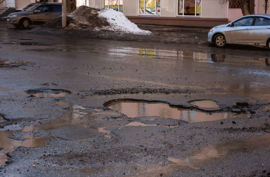
    With all of the environmental factors and traffic loads that pavements are exposed to on a daily basis, deterioration is inevitable. With newer or better pavement, only a few distresses may be present so repair costs are lower. However, as pavements age their deterioration continues at an increasing rate. These damaged pavements are more expensive to maintain and may even require major rehabilitation. Knowing the current age, condition, and maintenance history for a pavement section can help determine the most cost effective fix for it based on where it is in its life cycle. Systematic pavement evaluations are one tool network managers can use to monitor their pavement and make the best use of maintenance and construction budgets.

    What are pavement inspections and what do they do?

    Pavement inspections provide scientific data about the existing conditions of a network of asphalt or concrete surfaces. The process involves a trained inspector evaluating the pavement and cataloging all distress by size, quantity, and severity. With this data, an overall Pavement Condition Index (PCI) can be calculated. This PCI number is a single value that is used to grade the condition of each pavement segment. From there, a report that contains analysis on the condition of the network and a series of recommended solutions for any deficiencies is generated. Additionally, the report may contain specific maintenance recommendations for each road, budget recommendations, trends in pavement conditions, and ideas on how to stretch a limited pavement budget to maximize the overall system condition.

    What is the value of a pavement inspection?

    A pavement inspection report is a key tool for decision makers to use when determining capital improvement plans and setting budgets. It provides data and rationale to support funding decisions on projects that can be shared with interested parties. The systematic method of determining roadway conditions ensures the most cost-effective and critical projects are being planned for without guessing or relying on personal opinions. In most cases, the cost of implementing pavement inspections pays for itself by optimizing the time and location of pavement repairs. Additional cost savings can be realized when planning the projects 5-10 years out so that similar projects types can be group into larger more cost effective projects.

    WSB has the technology and expertise to develop a pavement management plan for your community. Contact us to learn more about a plan for your community.

    Matt Indihar is a Sr Project Manager with over 10 years of experience in construction and project development. He leads our pavement management team and has been involved in making pavement decisions in over 50 municipalities, written research based reports on pavement management processes, and participated on technical advisory panels for pavement research and innovation.

    [email protected] | 218.341.3614

    Deadline for Congressionally Directed Spending Approaching

    February 27, 2023
    By Bart Fischer, Sr Public Administrator, WSB

    Minnesota’s congressional delegation is now accepting applications for congressionally directed spending (CDS) requests. CDS can help fund key infrastructure projects for cities throughout Minnesota. The deadline to apply is March 10, 2023, at 5pm (CT). 

    With the deadline fast approaching, here are a few things that you can do as you prepare to submit your CDS request. 

    1. Submit individual applications to Senator Klobuchar, Senator Smith and your House Representative as recommended in the delegation request questionnaire. Doing this will help your project gain traction and approval as it moves through the submission process. The more offices looking at your request, the greater the chance that it will be approved for funding. 
    1. Connect with congressional staff to talk about your project. Although the deadline is tight, reaching out to congressional offices and staff to set up even a brief zoom or phone call to talk about your project ensures your project is on their radar before you submit it for consideration.  It’s also a positive long-term strategy to build meaningful relationships that can benefit your community and future projects. 

    The Application

    The application for CDS funding is broken down into three sections. The first section is the funding request. For this section it is important to know the project cost, city information, and if you are submitting multiple proposals. 

    The second section is focused on the project description and why it’s critical for your community. Here you will need to know things such as start date, description, justification, and whether or not your project meets eligibility requirements (eligibility requirements can be found here). 

    The final section of the application is funding background information, so be sure to include past funding and future project funding needs. 

    How WSB Can Help 

    Due to a rapidly approaching deadline, it is important that requests are submitted as soon as possible! If you need help with the application, understanding eligibility requirements, or building relationships with your congressional delegation, our team can help. We are able to assist with consultation, application submission, and connecting you to the right people to ensure your project has the best chance for success.

    Bart Fischer has over two decades of experience in public administration. Throughout his tenure, he’s worked in five Minnesota communities as the city or assistant city administrator. Bart joined our firm in 2019 as a senior public administrator and focuses on lending his public service expertise to our clients.

    [email protected] | 651.485.1839

    Pavement Inspection

    Q&A with Bart Fischer | Reducing Greenhouse Gases Through Sustainable Pavement

    February 13, 2023
    By Bart Fischer, Sr Public Administrator with Joe Carlson, Project Engineer and Amy Fredregill, Sr Director of Sustainability, WSB

    Government entities, at all levels, are working on plans to reduce greenhouse gasses. Many cities have been establishing sustainability and climate plans that aim to decrease their carbon footprints while some states have enacted laws to support more climate-friendly building practices.

    When it comes to building resiliency and establishing more sustainable practices, pavement isn’t always top of mind. Bart Fischer, Sr. Public Administrator, sits down with Joe Carlson, Materials Project Engineer and Amy Fredregill, Sr. Director of Sustainability to discuss the advancements in sustainable pavement and how cities can help achieve their resiliency goals

    BF: First, what is driving the push for more sustainable pavement options?

    AF: There is an increased focus across the nation to reduce greenhouse gases and build resiliency. A lot of this is being driven by evolving customer demand and federal, state and local government. I think we’ll start to see more incentives and expanded programs in the coming years related to this developing area of emphasis. For example, the Governor of New Jersey signed the Low-Carbon Concrete Law earlier this year. The bill allows producers to receive an income tax credit of up to 8% of the concrete cost for providing low-embodied carbon products on state projects. It’s thought to be the first tax-incentive-based legislation of its kind in the nation.

    JC: We are also seeing this expansion across Minnesota. Recently the Minnesota Department of Transportation (MnDOT) issued a provision to their specifications that allows an increase in the Recycled Asphalt Pavement (RAP) content that new asphalt mixtures can contain. Prior to this adoption, most mixes were only allowed to contain up to 20% RAP. Increasing the allowable RAP content leads to a significant reduction of carbon dioxide (CO2) emissions while simultaneously bringing down the cost of asphalt for owners.   

    BF: Interesting. I didn’t realize that sustainable pavement options existed until recently. What are you seeing or hearing in the pavement industry?

    JC: I’ve been hearing a lot of talk about concrete that has CO2 injected into the mix. This allows CO2 to be incorporated and locked into the concrete mixture and prevents it from being discharged into our atmosphere. Injecting the CO2 into the concrete has benefits including an increase in strength. The cost has little impact on the overall price of the concrete mix.   

    BF: Stronger concrete and competitive pricing seems like a win for everyone. Anything similar in the market for asphalt?

    JC: There is a recycled fiber reinforced asphalt available that is used for mill and overlays that provides performance benefits that dovetail with advancing sustainability goals. The fiber reinforced asphalt contains recycled plastic fibers that prevent what we refer to as reflective cracking. Reflective cracking occurs when there are cracks left in underlying layers of asphalt after milling. These underlying cracks come through (reflect) into the new pavement overlay surface rather quickly. The recycled plastic fibers are said to extend the life of the asphalt and significantly reduce the number of reflective cracks that develop. Extending the lifecycle advances sustainability because it reduces cost, waste, materials use and the overall footprint of a project.

    How can cities implement sustainable pavement in their communities?

    AF: Sustainable pavement is one area where cities can build resiliency and help reduce their carbon footprint, sometimes as stand-alone efforts, or increasingly as part of climate or sustainability plans adopted by cities we work with across the state. Net-zero goals and climate plans feel overwhelming but starting small has a major impact by testing out new approaches, engaging key stakeholders to get their feedback and build on their expertise, and learn from the experience. Sustainable pavement is one example of a minor change that has lasting impact.

    JC:  We don’t need to rely on construction materials to make an impact. Our industry tends to overbuild and overengineer leading to more expensive projects, resulting in a larger carbon footprint. Communities can achieve success by ensuring a strong geotechnical exploration program is performed prior to any type of roadway construction or reconstruction. The results of these explorations provide the community with vital information and options for pavement construction or rehabilitation methods. In addition, a robust pavement management plan results in a more strategic approach to maintaining and repairing roads before pavement rehabilitation options become limited and expensive.  

    Bart Fischer has over two decades of experience in public administration. Throughout his tenure, he’s worked in five Minnesota communities as the city or assistant city administrator. Bart joined our firm in 2019 as a senior public administrator and focuses on lending his public service expertise to our clients.

    [email protected] | 651.485.1839