Wildfires

The Impacts of Wildfire and Planning for Extreme Climate Events

By Tony Havranek​, Director of Fisheries, WSB

Wildfires are dominating headlines this summer as cities across the United States are dealing with the dangerous air conditions created by the fires in Canada. Wildfires can be incredibly scary, ushering in unwanted destruction and loss of property, but it can also be a tool for rebirth and habitat restoration.

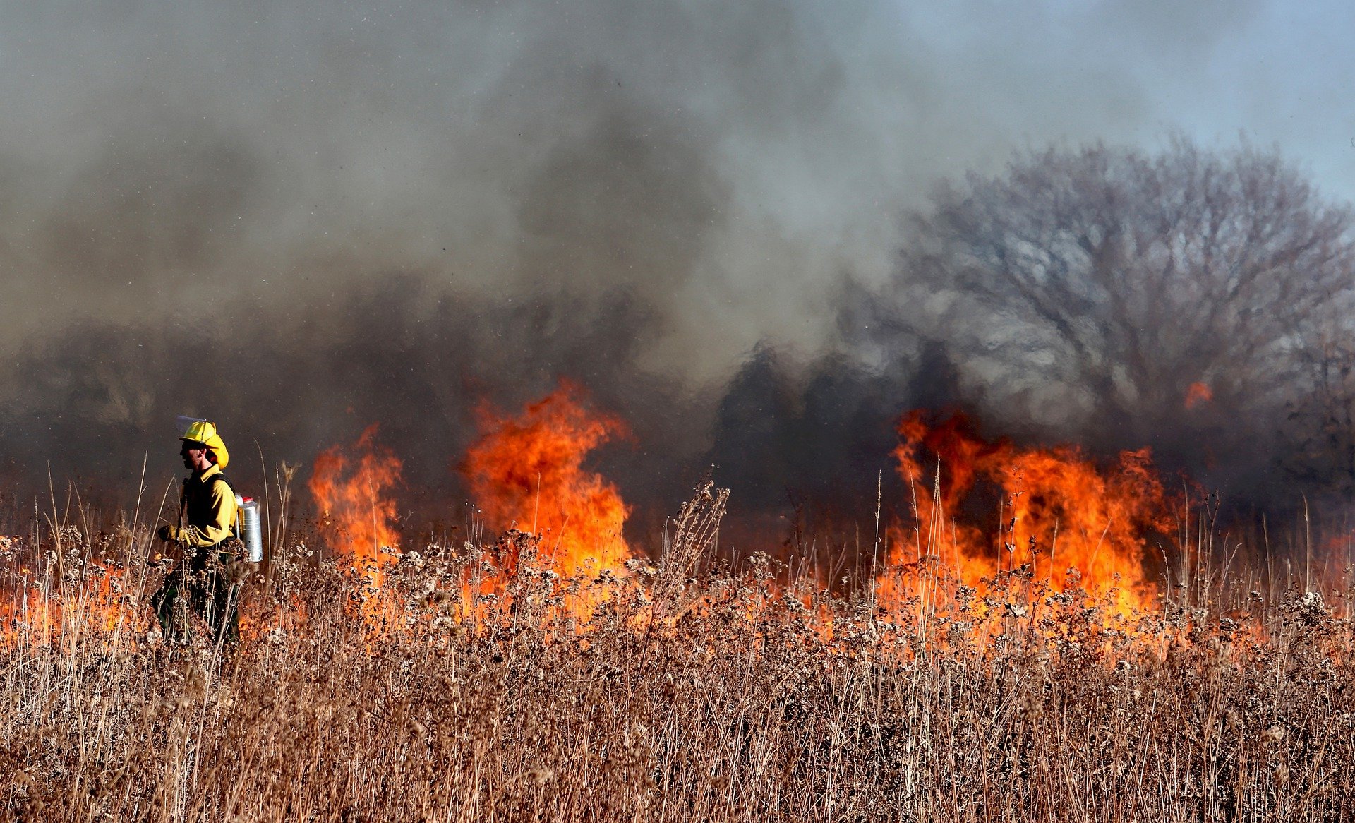
As an ecologist, I have used controlled fire as a tool. Taking a long view of plants and wildlife, many species rely on a natural cycle of disruption that includes fire, wind, animals and more. The Jack Pine, for example, requires fire to help open its cone and release seeds. Many invasive species don’t require cycles of disruption, on the other hand, and thrive among human development.

What are the Risks that Wildfire Bring?

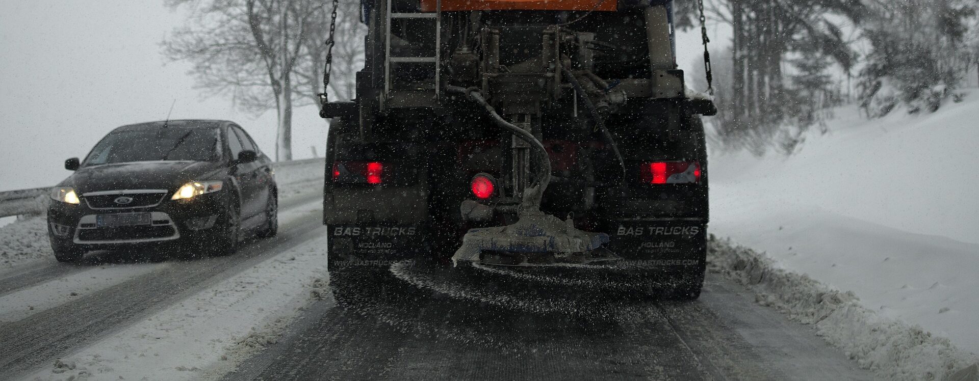
The clearest risk with any uncontrolled fire is destruction of life and property. Wildfires are incredibly dangerous, and this summer’s hot, dry weather helped exacerbate fires in the north. Furthermore, as climate change brings more extreme weather conditions, the carbon released from large wildfires drives further warming, feeding the cycle for more extreme weather events.

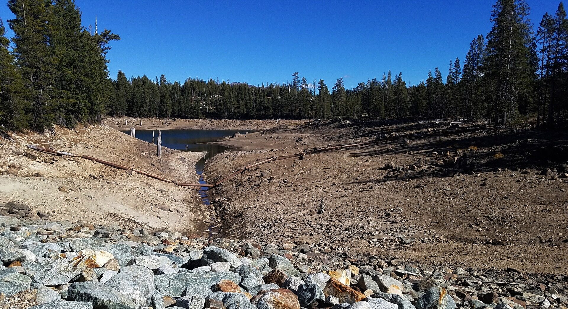
Poor forest management and extreme weather can also cause fires to burn more intensely. Too much fuel load – material in a given area that burns and can dramatically increase the intensity of a fire –means that a fire may burn faster and hotter. Intense wildfires can destroy soil to the point it is hydrophobic, repelling water instead of absorbing it. It can also destroy good bacteria and fungi in topsoil. The destruction of soil from extreme wildfires can make it more difficult for new plants to grow, cause soil erosion that pollutes streams and waterways, increase the risk of flash flooding and harm local ecosystems.

As fire crews work to fight wildfires, that can also bring some environmental risk. The flame retardant used to control the spread of fires can be toxic to certain plants and animals. And when fire crews travel from one part of the country to another to fight large wildfires, they can unintentionally introduce invasive species to new regions.

What are the Environmental Benefits?

When we read about wildfires in the news, the stories are often focused on destruction, but fire can bring environmental and ecological benefits too. Because humans have disrupted many of the natural fire cycles, burning can help reset plant species. Plants are an essential building block to ecosystems, and new plant growth can help reattract or grow the population of numerous native wildlife species. Moose, bears and deer are some of the species that can be positively impacted by regeneration after fires.

Better Planning for Fires and Other Natural Disasters.

While proper forest management and use of controlled fire helps mitigate the risk of destructive wildfires, climate change and human activity means wildfires, unfortunately could become more commonplace in certain parts of the world. Planning for and building defensible space and structures reduces risk from wildfires. Working with municipalities at WSB, we often talk about planning for flooding, erosion, hurricanes and other extreme weather events to protect infrastructure, people and native wildlife.

For communities, especially those that face a greater risk of wildfire due to climate change and other factors, assessing the threat of fire and integrating defensible space and structures into planning is critical. I expect that to become a more prevalent consideration as part of innovative municipal planning in future decades.


Havranek has nearly 20 years of experience in the natural resources field. Prior to his time at WSB, Tony helped develop federal policies with the U.S. Fish and Wildlife Service and worked with tribal communities throughout the Midwest on their natural resources needs. He is recognized throughout the industry for his forestry, water quality, fisheries, aquatic and terrestrial vegetation, wetlands and wildlife expertise.

[email protected] | 651.286.8473

Chlorides

The Road to Reducing Chlorides

By Chris Petree, Director of Operations, Alison Harwood, Director of Natural Resources, and Ray Theiler, Water/Wastewater Engineer

Understanding chlorides and making responsible decisions about them is challenging at best. They serve important functions in our everyday life, but they can also create lasting damage to the world around us. Learn more about how the chlorides are used on a day-to-day basis, what the long term affects are, and what options are available to properly manage them.

What are chlorides and how do they play a role in our lives?

Simply put, chlorides are salt. They play a big role in Minnesota life. Primarily, they are used in our water softeners to treat the state’s notoriously hard water and for de-icing the roads during winter months.

What negative impacts does over usage of chloride have?

Overuse of chlorides can affect our communities in a variety of ways. Understanding their full impact can be nearly impossible to calculate. Below are just a few of the ways people should be aware of.

Community water supplies: Many of our communities get their water from groundwater wells. They pull water from the ground to provide a public water supply. Excessive use of chlorides leads to groundwater contamination which makes its way into lakes and rivers and ponds, ultimately infiltrating the groundwater. When the groundwater develops high chloride levels or contamination, it becomes a safety issue that communities need to address.

Plants and wildlife: When concentrations of chlorides get high enough, it begins to kill plant life and setting off a domino effect in the eco systems. High levels of chloride destroy plant roots in aquatic systems resulting in fewer plants rooted to the lakebed. The lack of supportive root systems compromises bed stabilization and leads to more opportunity for sediment to be churned up, resulting in reduced water transparency and water quality. Salt used on roads can negatively affect wildlife and local pets. These animals often eat the salt used on roadways which can lead to illness or death. Even animals who need added salt in their diet are in danger, they are attracted to roadways (i.e., deer) causing safety concerns for the animals and drivers.

Infrastructure and transportation: Regardless of the application, we know that salt can be destructive and can lead to damage. Metal is particularly susceptible to salt damage.

  • High levels of chlorides on the streets have historically had a negative affect on vehicles. The salt on the roads builds up on the vehicles leading to premature rusting.
  • Pumping water with high chloride levels through pipes can lead to corrosion within water distribution systems, which in turn leads to issues with lead and copper in our water system.
  • The chlorides in the water cause premature degradation and failures of storm sewer systems, specifically in catch basins and manholes.

What are the benefits of reducing chloride usage?

The benefits of reducing chlorides are a long list that includes protecting the environment, the health of the community, and local infrastructure. However, often cost is the factor that really creates urgency around reducing chlorides.

Introducing the chlorides into the environment will ultimately require repair and rehab of groundwater systems, storm water systems, water infrastructure, wetlands, etc. All these systems have costs associated with them.

Acquiring the salt is another expense. Whether a small city, county, or state, the budget needed for de-icing is huge. Salt and de-icing chemicals are not produced locally. They can only be delivered by truck, train, or barge from the South. Taxpayer dollars are the how this transportation is funded, reducing chlorides frees up tax dollars to support other needs.

How to do you continue to maintain safe roadways in the winter, while meeting environmental regulations?

Technology and training are key.

It used to be that a salt truck was sent out with only a lever and a couple of dials for the operator to control salt usage. The technology and equipment currently available allows operators to apply the exact amounts of de-icing chemical needed based on precipitation type, air temperatures, and pavement temperatures. It is critical these staff are trained to use the equipment properly. Equipment and training will require an upfront investment but will ultimately save significant amounts of money on resources and damage repair done in the long run.

Some communities are exploring alternative de-icing chemicals beyond chloride. For example, you can mix in beet juice, molasses, sand, etc. There are many alternatives and mixtures that are less harsh on the environment, more cost effective and benefit communities in the long term.

How can communities help reduce chloride usage overall?

  • Make sure water softeners are functioning efficiently or upgrade to a higher efficiency model.
  • Explore those alternatives to road salt.
  • Educate: There are resources and trainings available.
    • MPCA Smart Salt Training: Educate businesses, property managers and residents. Its important communities take an active role in chloride reduction.
  • Involvement: Get communities involved by including information in community newsletters.

WSB can evaluate chloride usage and make recommendations for how to move forward. Our staff have the experience and knowledge, from years and years working at public agencies, that we can provide operational assistance and assessments when it comes to communities and planning.

Transportation

Annual Minnesota Transportation Funding Opportunites

There are many recurring transportation funding opportunities in Minnesota that are open for applications now and into early 2022. The list below provides additional details on each of the funds. Now is the time consider if your community has transportation projects that fit these programs. If you believe that your community qualifies and would like help with the application or if you’re not sure your project is a good fit, contact Bart Fischer ([email protected] or 651.286.8484) to learn more.

  • MnDOT’s Greater MN (Non-Metro) Highway Safety Improvement Program (HSIP) – This program aims to reduce traffic fatalities and serious injuries involving vehicles, bicycles and pedestrians on all public roads. It is open for applications September 3, 2021 – November 24, 2021. Eligible projects are categorized as proactive – projects that address known risk factors; and reactive – projects that address a sustained crash location.
  • MnDOT’s Metro Highway Safety Improvement Program (HSIP) – The HSIP solicitation for metro area counties will occur in spring of 2022. Like the Greater Minnesota HSIP, this program aims to reduce traffic fatalities and serious injuries involving vehicles, bicycles and pedestrians on all public roads. Eligible projects are categorized as proactive – projects that address known risk factors; and reactive – projects that address a sustained crash location.
  • MnDOT’s Safe Route to School (SRTS) Infrastructure – Applications will be accepted October 4, 2021 – January 7, 2022; letters of intent are due by October 29th, 2021. The program funds capital projects that promote and encourage more students to walk or bike to school by making routes to schools safer and more accessible. $7.5M is available, with minimum awards of $50k and maximum awards of $500k. There is no matching requirement.
  • State Park Road Account Solicitation – This MnDNR solicitation is open now through November 1, 2021. Funds are intended to improve local access roads to state parks, state campgrounds, public water access points, and other eligible recreational areas. Projects awarded funding must follow applicable state aid construction project requirements.
  • Federal Land Access Program (FLAP) Funds – This program funds construction projects on public highways, roads, bridges, trails or transit systems that are located on, adjacent to, or provide access to federal lands for which title or maintenance responsibility is vested in a state, county, town, township, tribal, municipal, or local government. A 20 percent match is required. Applications are due by December 15th, 2021. A preliminary review of applications is available for draft applications submitted prior to November 19, 2021.
  • Metropolitan Council’s Regional Solicitation – The next round of applications for the Metropolitan Council’s Regional Solicitation process will take place in the spring of 2022 to fund projects in 2026 and 2027. This solicitation, which is open for counties and communities within the seven-county Twin Cities metropolitan area, seeks applications for: roadways including multimodal elements; transit and travel demand management projects; and bicycle and pedestrian facilities. During the last round of the Regional Solicitation in 2020, approximately $200 million in federal transportation funds were awarded to 56 projects in 36 different cities and townships. 

The ABC’s of Bridge Safety

By Paul Kivisto, P.E., Senior Structural Engineer, WSB

Did you know that the average life span of a bridge is 60 – 70 years? There are a number of ways to reach or exceed that average. Newer materials like high performance concrete and epoxy/stainless steel rebars certainly improve the quality and longevity of a bridge. Regular bridge inspections are not only legally required, but by inspecting and documenting issues with your bridges you can hopefully slow the expected deterioration and make repairs early which often costs less.

MnDOT, counties, cities, townships, and tribal governments are all responsible for managing bridge assets within their jurisdiction. Many of these entities have inspectors on staff to perform inspections, while others contract out that work to private firms like WSB. Maintaining regular and accurate inspection data is necessary to ensure public safety, reduce liability, maintain accurate budgeting, and comply with state laws and regulations.

Five important aspects of bridge inspections

About Documents, Frequency, and Inspection process

MnDOT releases the Bridge and Structure Inspection Program Manual (BSIPM) which summarizes inspection guidelines. In Minnesota, all bridges and culverts over 10’ long and carry traffic or are over roadways must be inspected. An initial inspection is required within 3 months of opening to traffic. The typical inspection frequency is 24 months, with shorter time periods for bridges in poor condition. The bridge owner can request longer than 24-month cycle for culverts. The latest version is May 2021 and can be viewed here: https://www.dot.state.mn.us/bridge/inspection.html.  

Bridge Condition Codes

BSIPM Chapter B – Bridge Inspection Field Manual and Chapter D – Recording and Coding Guide should be used by inspectors during all inspections. Physical condition and geometric properties of each bridge are recorded on inspection and inventory forms.

  • Overall condition codes from the National Bridge Inventory (NBI) range from 9 (new) to 0 (closed) and track the overall condition of the superstructure, substructure, deck, culvert, and other elements.
  • More detailed element level inspections record percentages of elements in conditions ranging from 1 (new) to 4 (severe deterioration).

The owner must report inspection and inventory data through the Structure Information Management System (SIMS) database to MnDOT every year.  MnDOT in turn provides the data to the Federal Highway Administration (FHWA).

Channel Inspections/Waterway/Scour

One of the leading causes of bridge failures is scour or undermining of the substructures in, or adjacent to, water. Scour is the term used to describe the erosion of soil surrounding a bridge’s foundation. When fast-moving water moves sediment from around the foundation, it creates scour holes adjacent to substructures that must be identified and monitored. Degradation of channels can cause shifts in the channel and may increase the risk of undermining. Bridges that cannot be inspected by wading and probing must be included in the statewide underwater inspection program on a 48-month cycle. Channel cross-sections are required for scour critical bridges and recommended for unknown foundations and scour susceptible bridges.

Additional causes of bridge deterioration to be aware of include:

  • Rebar and steel corrosion due to chlorides
  • Delamination and spalling on concrete members
  • Shrinkage cracking in concrete
  • Fatigue cracking on steel beams
  • Vehicle impacts to members
  • Leaking expansion joints
  • Bearings moved out of position
  • Timber decay

Drone Inspections

Increasingly, drones are used to provide access to hard-to-reach portions of bridges. They have photographic and video capabilities that allow them to identify cracking, spalling, and other deterioration that is otherwise challenging to document. Drones have the additional benefit of using Infrared (IR) cameras to identify delamination and distress below the surface.

Engaging with the Inspection Data

Agencies should use inspection data to help identify maintenance, preservation, improvement, and replacement projects. It is critical that accurate inspection data be maintained to track deterioration over time and prioritize maintenance work. Additional detailed inspections may be needed to help put together a system-wide scoping analysis or bridge management plan (BMP).  A thorough BMP can help identify funding needs over a given budgetary cycle.

Paul has more than 36 years of experience in bridge construction, bridge management, bridge inspection, and bridge design. In his role as Metro Region Bridge Construction Engineer for MnDOT’s Bridge Office, Paul was responsible for writing foundation recommendations, bridge preservation and improvement recommendations, constructability reviews, recommended repairs, and identified projects for inclusion in MnDOT’s bridge preservation program.

[email protected] | 612.201.9163

Keeping Projects in Compliance During Times of Drought

Meghan Litsey, Director of Environmental Compliance, WSB

Minnesota has experienced drought before, but this year is unique. Drought conditions began earlier than normal and are anticipated to continue through October. Despite recent rainfall, it will take much more precipitation to ease drought impacts as we head into fall. Although drought has major impacts on many facets of municipal infrastructure, it can also have many impacts on ongoing construction projects.

NPDES Construction Stormwater Permit impacts

Vegetation is key to closing out any ongoing project. As construction season begins to come to an end and projects begin close-out activities, the ongoing drought presents several challenges. The NPDES Construction Stormwater General Permit requires permanent uniform perennial vegetation with a density of 70% of its final growth. Given the challenging conditions this year, some projects may need to consider delaying permanent seeding until conditions improve. 

Alternatives to consider

Rather than applying permanent seed mixtures and risking failure, waiting until conditions improve is worth considering. Another option to think about is dormant seeding. Dormant seeding can be an effective method of maximizing growth in the spring, especially when native species are involved.

Five ways to stay in compliance

  1. Always be ready for the next rain event. Continue to install and maintain erosion and sediment control best practices and stabilize exposed soils within permit timeframes.
  2. Control dust with water or chemical application, as needed.
  3. If delaying permanent seeding, use stabilization placeholders, such as straw mulch, erosion control blanket, or hydraulic mulch, to cover exposed soils until permanent turf can be completed.
  4. Continue to perform weed control to prevent excessive weed growth. This may include tilling, mowing, and/or herbicide applications.
  5. If permanent vegetation has been established and there are bare areas that need to be supplemented, use interseeding and overseeding to obtain uniform coverage.

Although vegetation may be minimized when looking at a project’s big picture, it has considerable impacts on stormwater runoff. The U.S. Environmental Protection Agency estimates that 20 to 150 tons of soil per acres are lost every year to stormwater runoff from construction sites. The NPDES Construction Stormwater General Permit monitors stormwater runoff during and after construction, protecting many of Minnesota’s natural and water resources. Establishing quality vegetation, even during a drought, can be a challenging feat but is necessary to maintain compliance and protect our water resources.

Meghan Litsey is director of our Environmental Compliance team and has over eight years of experience. She specializes in providing environmental compliance services in construction site permitting, SWPPP design and inspection, and MS4 program development. 

[email protected] | 763.287.7155

Solving Complicated Water Issues

The Minnesota Pollution Control Agency (MPCA) and Minnesota Department of Natural Resources (DNR) recently released their $700 million plan for improving the drinking water supply in 14 communities that are currently dealing with unsafe levels of perfluoroalkyl and polyfluoroalkyl substances (PFAS) in their water. The government’s plan includes building or expanding:

  • Six new water treatment plants
  • Treating 33 municipal wells
  • Connecting 296 homes to municipal water systems
  • Providing home water filtration systems to homeowners with private wells

WSB was fortunate to be involved with the city of St. Paul Park to help them find a solution to increasingly dangerous PFAS levels in their community. In June of 2018, the Minnesota Department of Health informed St. Paul Park that the PFAS levels in two of its three water wells was exceeding the recommended levels that are safe for public consumption. WSB partnered with the city to design a water treatment facility and remove PFAS from the community drinking water and surrounding environment.

PFAS are a family of manmade chemicals that do not naturally decompose due to their heat and water-resistant structure. Studies have found that consuming drinking water with elevated levels of PFAS, overtime, can be associated with high cholesterol, reduced immune response, thyroid disease, kidney cancer and other distressing health problems.

After completing a rapid column filtration pilot study, acid-washed granular activated carbon filtration was selected as the most feasible, long term solution to treat PFAS in the city’s drinking water.

  1. Steel pressure filtration vessels contain granular activated carbon filter media that facilitate the transfer of contaminants onto the media as the liquid stream passes through the vessels.
  2. When the contaminant level in the carbon bed reaches the saturation point, the carbon is removed and regenerated at an off-site facility or disposed.
  3. After the media becomes fully absorbed with PFAS, the media is removed from the vessel and refilled with high quality activated carbon.

The project utilized an innovative modeling software, Matterport, to video scan the interior of the plant and provide a three-dimensional layout. This model allows city staff to provide accurate virtual tours of the plant remotely. Matterport also serves as an asset management tool for storing critical operations and maintenance data for each piece of equipment inside the plant. This innovative tool allows staff supervisors to reference and provide instructions to their teams from a remote location. Leveraging Matterport software ensures important equipment data, plant drawings, and schematics can be accessed from any location with Wi-Fi or internet connection.

Great emphasis was placed on the design to protect the environment and provide a sustainable facility. The plant produces almost no emissions that affect the environment other than space heating during the winter months. Nearly no wastewater will be emitted from the plant in the long term other than discharging backwash wastewater into the sanitary sewer system about once every two to three years when the filter media is exchanged for new media. On site, a large oak tree situated about 20 feet from the plant was preserved during construction. Since the plant was constructed in a city park, all areas that were affected by construction were restored with landscaping and grass that creates a natural flow to the surrounding athletic fields.

Since the plant was placed into service, no PFAS contaminants have been detected in the effluent water that is distributed to city customers. The quality of the drinking water has been excellent and exceeds all drinking water and health standards.

Reasons municipalities implement water restrictions

Alyson Fauske, Sr Municipal Project Manager, WSB

In Minnesota, also known as the land of 10,000 lakes, many people wonder how even in times of severe drought, we don’t have enough water. As of early August, over 35% of the state is now experiencing extreme drought conditions. These drought conditions significantly impact municipal water supplies.

The type of water that cities supply to their residents is treated for a number of economic and environmental reasons. Cities around the state measure the annual average demand and peak demand, but drought conditions like we’re experiencing now, fall outside of annual averages.

In the last several weeks, many cities have implemented additional restrictions, and many residents don’t understand how these restrictions can help restore water levels within a matter of hours. Although it doesn’t seem like limiting irrigation or water use would have much of an impact, it significantly improves a city’s supply.

Enacting water restrictions alleviate the demand and can prevent communities from falling below fire protection and boil water levels. The below diagram shows an example of a water tower’s levels in a week. Water towers have censors that measure elevations. There is a minimum water level within the water tower to provide adequate fire protection. In our example, that level is 21 feet, meaning if there were a fire and the water tower level was below 21 feet there may not be adequate supply to fight the fire. 

There is also a minimum level that needs to be maintained in the water tower to ensure that the pressure in the system is high enough to keep contaminants from entering the water system. In our example, if the water elevation drops below 10 feet a boil water notice would be implemented. 

There are several actions that communities are taking today to help limit water usage including developing water reuse systems and plans, adjusting landscaping to include more native, drought resistant plantings and grasses, and reducing overall water consumption.

Instances of severe drought remind us that water is not a limitless resource and that forces outside of our control can have major impacts on our infrastructure.  

With 20 years of engineering experience in the municipal industry, Alyson Fauske has built her career providing municipal engineering services throughout the Twin Cities. Her portfolio of work includes street and utility reconstruction, technical analysis and field observations, direct project planning and management, and comprehensive and capital planning services.

[email protected] | 763.512.5244

Every Project Should Use Active Visualization

What does the popular online video game Fortnite and WSB have in common? Active 3D visualization.

Visualization is the process of building a model of a project site that can aid in the iterative design process and construction of a project. The technology has been used for decades and can be categorized as passive or active.

Passive visualizations are 3D visualizations that have been created from individually rendered frames and cannot be updated in real time. The supplemental tools to work on a passive visualization are filters and photoshop. The process of designing a project through passive visualization is inefficient and expensive. That’s why, in 2017, the technologically advanced engineering firms, including WSB, moved towards active visualization. Active visualizations allow us to produce project renderings in real time and make edits to those renderings in seconds. The software engine and graphics cards we use to create active or real-time visualizations at WSB are the same technology used for developing industry leading games.

Active visualizations can be used to create renderings on several different project types. From landscaping to transportation, any project with a design phase can take advantage of the state-of-the-art technology. This is important because active visualization can offer several benefits including realism, flexibility and certainty.

Realism

Until active visualization software was created for Fortnite, the engineering industry relied on passive visualizations and its tools. The visualizations looked fine but were not realistic. Consider a municipal client who may be interested in rebuilding three blocks of their downtown. Within an active visualization, a client can pick a place anywhere in the three-block radius and “walk” through the town with the use of only a computer and a mouse or keyboard. They can see the color of the buildings, the species of the trees and flowers planted alongside the sidewalks and even review the various concrete dyes within the scene, all within real-time, and all while changing the time of day to review color hues.

Flexibility

A client gets a clear picture of what those new three city blocks will look like because of the realism of the designs and that influences flexibility. Active visualization is flexible because the software allows a designer to make changes in seconds. For example, if a client did not like the color of the buildings in the rendering, a designer can change it in real time. This is great for trying new and different ideas. It can also help a client save money by making clear decisions about other design elements before ordering materials such as light poles, wayfinding signage, flowers and trees or other design elements.

Certainty

Active visualization allows a client to make quicker decisions in a design so they are certain they will be happy with the result. The certainty for the client also helps build trust during public engagement processes. The realism and flexibility of the renderings lead to less interpretation by a viewer, whether they are a client or community member.

Active visualization has become the standard at WSB for municipal and landscape architecture projects and will no doubt start to be used for other projects soon. The benefits of realism, flexibility and certainty help ensure each project is delivered on time, on budget and at the highest quality.

Evaluating Solar Panel Effects on Wetlands

By Shawn Williams, Sr Environmental Scientist, WSB

Wetlands are vital and dynamic ecosystems that provide numerous benefits to society, including improved surface water quality, flood control, groundwater recharge, and of course wildlife habitat. Wetlands are regulated aquatic resources in the state of Minnesota.

The Wetland Conservation Act (WCA) ensures that all wetlands that are disturbed, brought into non-aquatic use, or its function and value are significantly altered are restored or replaced. In the past, the posts/pilings that are used to install solar arrays have not been considered a wetland impact that would require compensatory mitigation under the WCA. The reality is that solar arrays bring wetlands into non-aquatic use and may, or may, not negatively impact the wetland’s quality or function.

Historically, solar arrays have been sited within or near farmed wetlands (wetlands that are plowed).  If solar developers restore the disturbed wetlands following construction, such as with native plant species, the function and value may actually improve, despite the shading from the solar arrays.

To help local governments evaluate the potential impacts to a wetland’s function and value, the Minnesota Board of Water and Soil Resources (BWSR) issued guidance that provides a suggested approach for evaluating projects when they involve the installation of solar panels on posts/pilings in wetlands.

The guidance document can be found on the BWSR website and includes three steps:

  1. Evaluate the wetland’s condition
  2. Determine the wetland’s current functionality, and
  3. Evaluate the effect of the project on the condition and function of the wetland

WSB’s experienced Natural Resources staff are available to assess wetlands to determine the general quality and function/value they provide to the ecological setting and society. The regulatory review and technical assessment will determine if the project wetland impacts require replacement.

Please contact Shawn Williams at 612-360-1305 or [email protected] for additional information or project support.

Shawn has over 16 years of professional environmental consulting experience. He prepares site permit applications, avian surveys, wetland delineations and reports, habitat assessments, and threatened and endangered species reviews. He is trained in wetland delineation methods, wetland plant identification, floristic quality assessment methods, NPDES compliance, and Geographic Information Systems (GIS).

[email protected] | 763.287.8531

Engineering Needs More Surveyors

By Brad Oswald, Director of Survey Operations, WSB

Some elements of engineering are bright and shiny. Surveying is not classically considered bright and shiny. The work of a surveyor often goes unnoticed, but it is an important step to delivering a project on time and within budget.

A surveyor measures land, considering the topography of a project site, to delineate where to put infrastructure like pipes, wind turbines, solar arrays and more.

You may need a surveyor if you are:

  • Buying or selling a home or piece of land
  • Dividing a larger piece of land into smaller pieces
  • Installing a fence or pipeline

At WSB, developers, construction companies and their contractors rely on surveyors to perform boundary and land surveying on small and large projects. Boundary surveying is when a surveyor establishes the boundaries of a project site. A surveyor can tell you exactly where the boundaries of your property are, so you know what is and isn’t yours, and what’s developable. Next, a land survey will identify any easements or encroachments on the project site to determine where site improvements can be placed. The surveyor then provides a base map to engineers, who start designing the site. Once the site is designed, a surveyor will stake the design on the ground, so contractors know where to build on the site.

These steps help prevent any legal or monetary liabilities. A new homeowner may want to build a fence on their property. If they build that fence without surveying the property, they could be hit with a lawsuit if the fence encroaches on the neighboring property. Consider it on a much larger scale. A developer may plan to install wind turbines on a site. After paying the thousands of dollars to install the turbine, they could find that the turbine is encroaching on a neighboring property. Surveyors can mitigate these problems long before the wind turbine is in the ground.

Right now, the surveying industry is facing a challenge.

Less people are entering the industry. The engineering industry must come together to underscore the importance of surveying. Opportunities in the space are growing, too, as industries are focusing on increasing renewables projects across the country, even the world. These projects include pipelines, wind turbines, solar arrays, transmission and transportation projects.

Technology is also enhancing the field. With more satellites orbiting the Earth, improved GPS technology makes the job not only more efficient, but more interesting. Drones are also being utilized on larger project sites.

The work of a surveyor is critical to delivering a project, as designs and builds are based on surveys. The workforce must grow with the industry to ensure all projects are successful.

Brad has 23 years of experience in the land surveying industry with the last 18 focused on management, project delivery and mentoring. He has extensive experience in the electric and federal market sectors providing boundary, ALTA/NSPS, topographic surveys and construction staking.

[email protected] | 248.686.4745