5 Ways To Improve Pedestrian Safety For All Residents

August 14, 2023
By Gus Perron, Project Manager, WSB

In recent years, there has been a distressing increase in pedestrian-vehicle collisions, highlighting the vulnerability of pedestrians on the road. Several reasons have contributed to this surge including the unforeseen impact of COVID-19, which kept people off the roads for extended periods, leading to increased speeds and reduced vigilance. Moreover, distracted driving due to the prevalence of smartphones and electronic devices, impaired driving, speeding and inadequate pedestrian infrastructure have all played a role in pedestrian-related accidents and fatalities.

Combating this concerning trend necessitates a comprehensive approach encompassing awareness campaigns, responsible driving habits, and improved infrastructure to prioritize pedestrian safety and reduce these tragic accidents.

Here are five things communities can do to increase pedestrian safety.

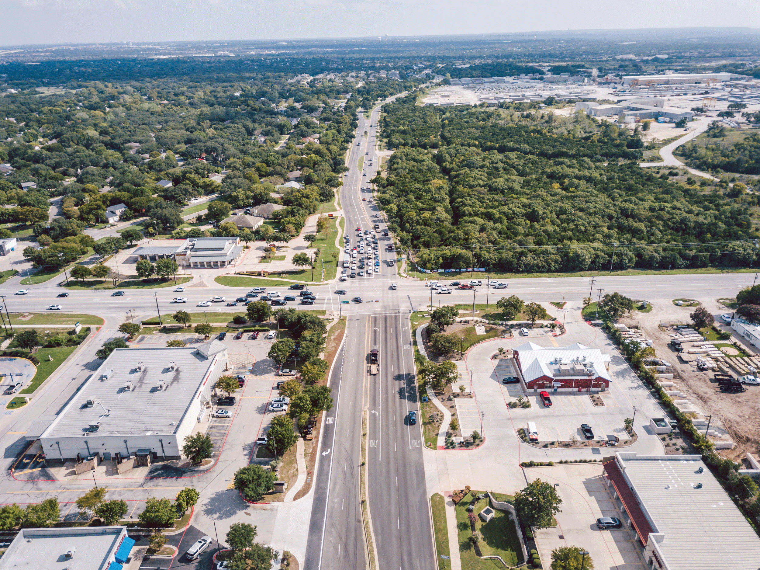
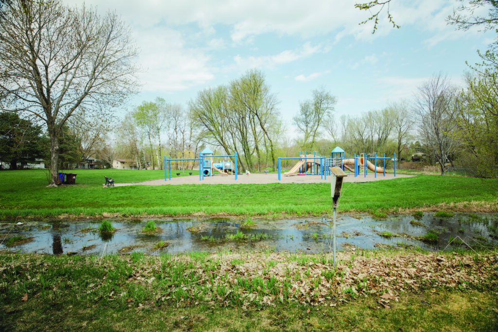
Implement a Complete Streets policy

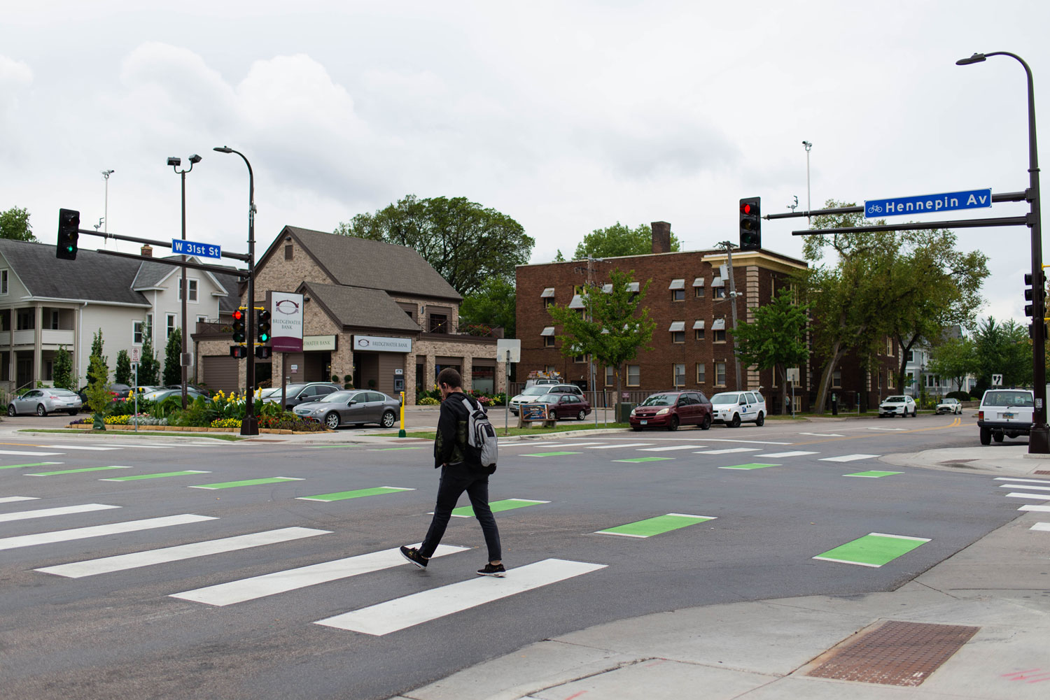
Communities should consider a Complete Streets transportation policy that prioritizes the safety and accessibility of all road users. That means finding balance and designing streets that cater to pedestrians, cyclists, public transit users and motorists. Complete streets encourage active transportation and promote pedestrian safety. With dedicated bike lanes, well-marked crosswalks and improved transit facilities, the policy fosters a pedestrian-friendly environment while enhancing overall traffic flow. By combining these elements and striking a balance, communities can advance holistic solutions to improve safety for all users. 

Protect students with Safe Routes To School

Safe Routes to School is a national program dedicated to enhancing pedestrian safety for students traveling to and from school. By funding and implementing infrastructure improvements and traffic calming measures, Safe Routes to School creates safer pathways, crosswalks and bike lanes for children. Moreover, the program emphasizes educational initiatives to promote road safety awareness and responsible pedestrian behavior. Cities should explore grant funding opportunities for safe routes to school projects. 


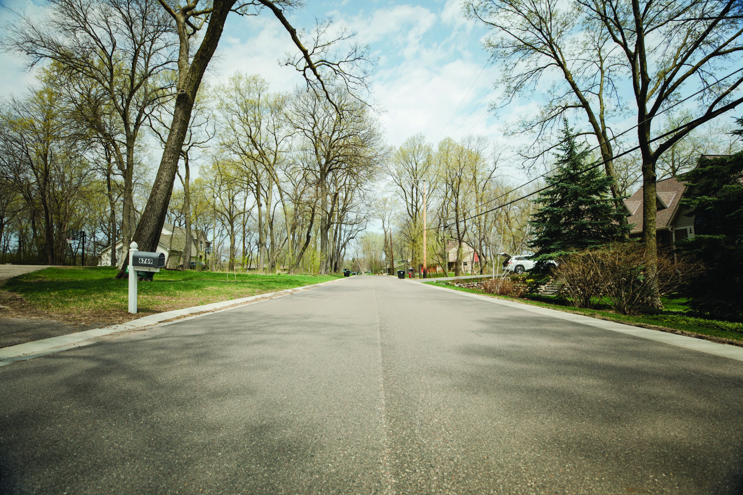
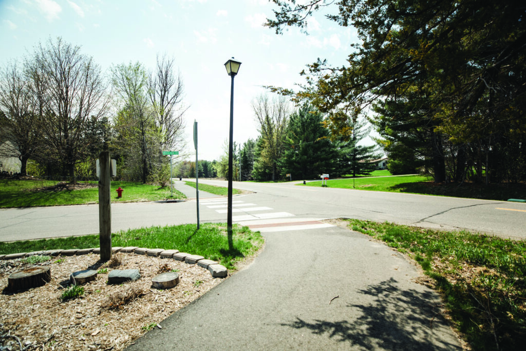
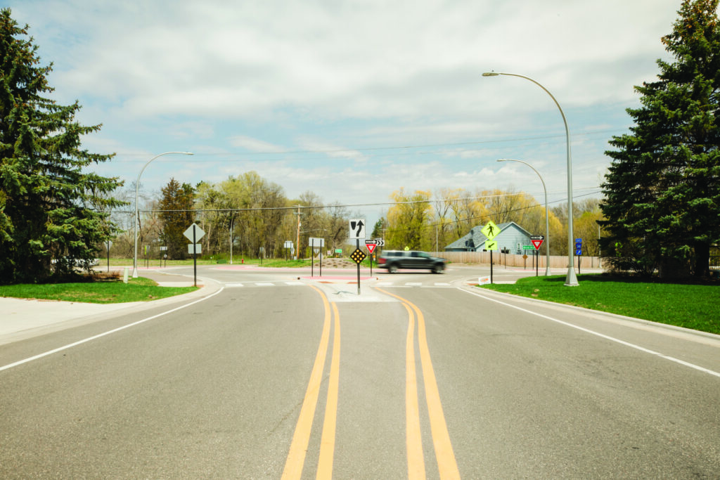
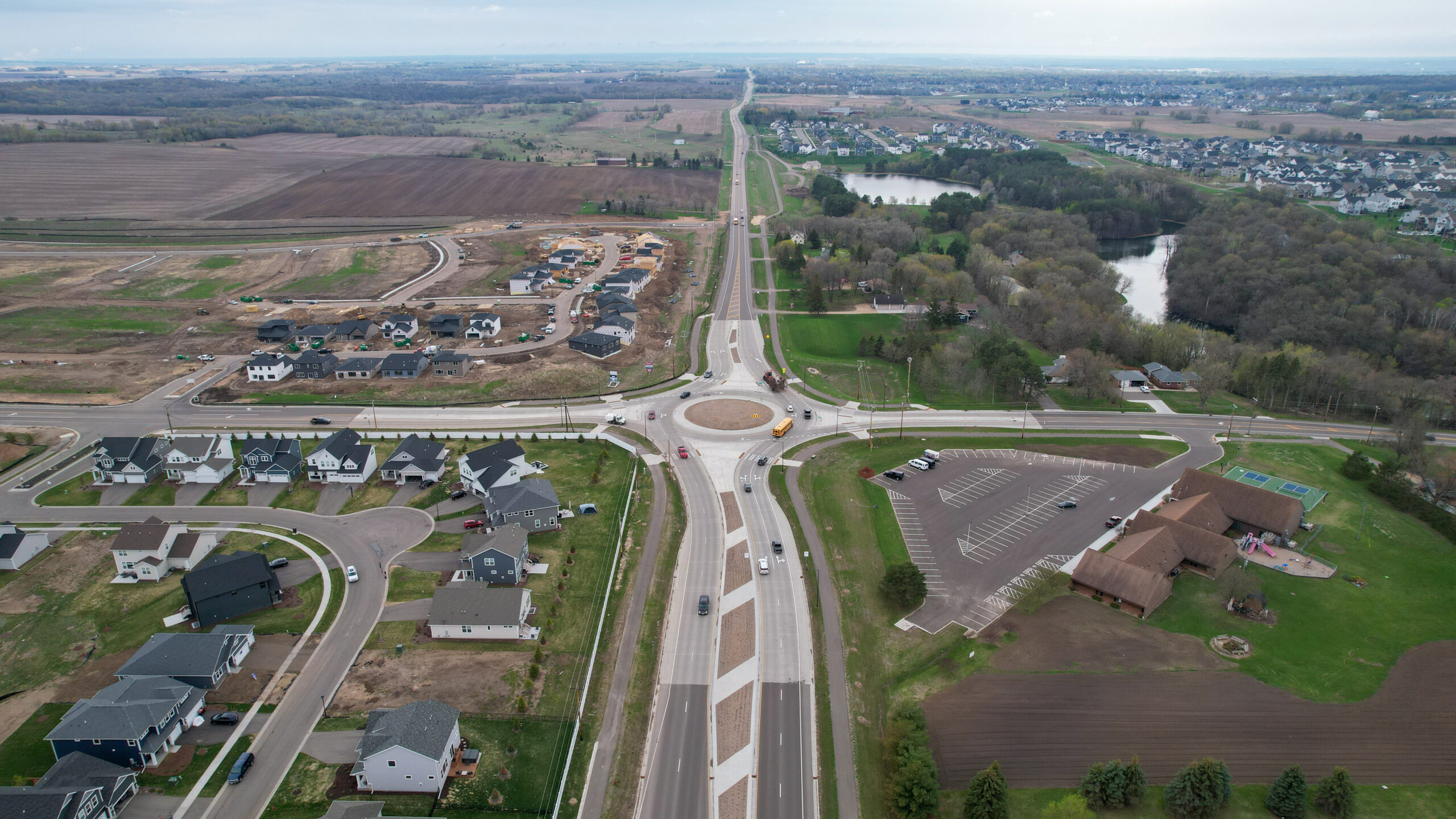
Adopt a policy on uncontrolled crossings

Uncontrolled crossings, characterized by the absence of stop signs or traffic signals, pose significant safety challenges for pedestrians. To address this issue, it is crucial to develop a comprehensive policy that clearly communicates what a community’s rules and priorities are at these types of crossings. Building local support is essential in gaining traction for the implementation of appropriate measures which could include installing marked crosswalks, warning signs, pedestrian refuge islands, curb extensions (bumpouts) or beacons to enhance pedestrian visibility and safety. By proactively addressing uncontrolled crossings, local authorities can create safer road environments and protect pedestrians and drivers from potential hazards.

Design facilities for pedestrians of all abilities 

Ensuring safe and accessible facilities for pedestrians with physical disabilities at crossings is of the utmost importance, a protected civil right. There must be sufficient signal crosswalk times so people with mobility issues can cross safely. Additionally, implementing detectable warning surfaces at curb ramps can serve as tactile indicators for those with vision impairments, alerting pedestrians that the protection of the sidewalk is ending and a crosswalk is beginning. Sidewalks should also be wide enough and without barriers, cracks, large gaps, etc. to ensure they are usable for people with disabilities including wheelchair users. 

By incorporating these features, municipalities can enhance pedestrian safety and create a more inclusive and accommodating environment for everyone. 

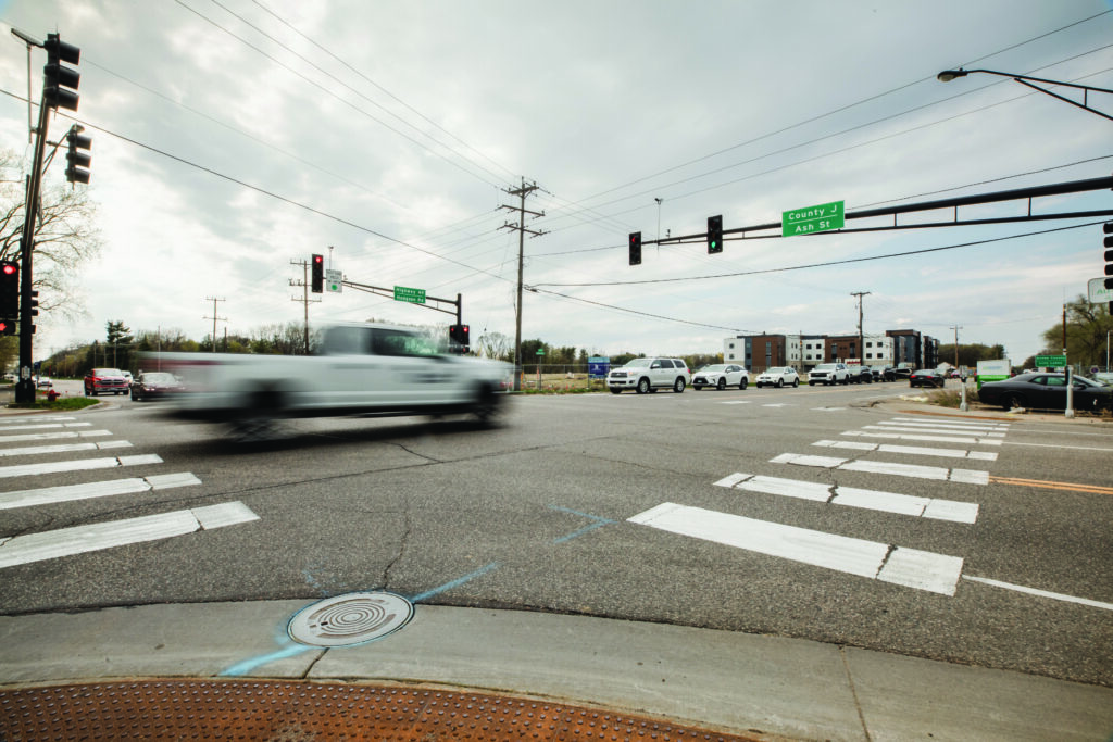
Consider the technology and tools that work best for a crossing 

Different types of beacons can serve different types of crossings, so communities should explore what works best. RRFB (Rectangular Rapid Flashing Beacon) warning lights can be installed, requiring pedestrians to push a button to activate flashing lights, alerting vehicles that people are crossing. Alternatively, a Pedestrian Hybrid Beacon, activated by pedestrians, can operate similarly to a traffic light, flashing yellow and red to control traffic flow. Although the Pedestrian Hybrid Beacon may cost more upfront, it becomes more advantageous for pedestrians in areas with higher traffic volume or faster vehicle speeds. By integrating these technologies, communities can improve the overall pedestrian experience and improve safety. 

How WSB can help

WSB plays a vital role in enhancing pedestrian safety and accessibility. We can help communities identify funding, develop policies, as well as scope, design, and construct pedestrian infrastructure enhancements. By thoroughly analyzing the impact of traffic solutions for vehicles and pedestrians, including those using mobility devices, they ensure comprehensive and inclusive planning, balancing the needs of pedestrians, bicyclists, and motorists. Drawing from their depth of experience, WSB actively listens to clients’ needs, tailoring individualized plans that address specific community needs. With a keen focus on safety, WSB considers existing speeds, crossing widths and traffic volumes to identify the most effective solutions to mitigate potential fatalities. Leveraging the latest technological tools for data collection, WSB can assess data to identify areas of highest need, allowing for practical and data-driven improvements.

Gus is WSB’s expert in accessible pedestrian and bicycle facilities, with a traffic engineering background which allows him to blend pedestrian accessibility with safety and mobility. He uses best practices to achieve constructable and usable pedestrian facilities for a variety of project scopes across different environments.

[email protected] | 612.360.1296

Build Resilience into Water Reuse Infrastructure and Systems

August 14, 2023
By Bill Alms, Project Manager, WSB

The Midwest is experiencing a drought this summer. High temperatures and scarce precipitation have led many communities to implement watering bans and other solutions to help manage limited water resources.

For community leaders, it’s crucial to recognize that addressing drought and the impacts of climate change is a marathon, and not a sprint. While drought is top of mind for communities right now, it is equally essential to adopt a long-term perspective, and explore investing in systems and infrastructure that will minimize the impacts of drought and flooding in the long term and protect potable water supplies.

How can communities think long-term about water resiliency, reuse systems and planning? Here are some things to consider.

Invest in Resilient Water Systems that Can Handle Climate Extremes

Cycles of drought and flooding are becoming more common as global temperatures rise. Ensuring access to clean, safe water is critical for communities, and that means investing in infrastructure and water reuse systems that are efficient, effective and resilient.

WSB worked with Hugo, Minnesota on a sustainable water reuse strategy more than a decade ago, helping them build resiliency into systems. From reducing potable water use in landscaping, to placing reservoirs in strategic locations to ensure adequate water supply for high use areas, to educating the public on the importance of water conservation and reuse, the city’s water reuse strategy has been successful. It’s also made their water systems less susceptible to drought and climate change.

Communities looking to find similar success should approach water reuse and infrastructure in steps.

  1. Start with a feasibility analysis. Communities should begin with a feasibility analysis to determine areas with the lowest water supply, high water consumption, and inefficiency points. Based on this analysis, authorities can establish priorities, discerning which places require the most water and where there is greatest demand. Facilities like athletic complexes, schools, and manufacturing plants, which consume substantial amounts of water, should be evaluated accordingly. Pairing a usage map with existing sources can help determine how to build a more integrated and efficient system.
  2. Think regionally. It’s important to think regionally when planning for water reuse systems instead of site by site. How far apart are water sources? Where is the greatest consumption? Thinking about how pump systems can serve larger areas, placing retention ponds in strategic locations best suited to collect stormwater, and connecting water sources across a community promotes greater efficiency and benefits the environment, especially under drought conditions.
  3. Understand the value of long-term investments. When investing in more resilient water reuse systems, communities may be deterred by significant upfront costs, but the long-term benefits are significant. Communities should look at water reuse systems like other utilities and how to best maximize return on investment for everything from pumps to irrigation systems, to reservoirs. Adopting large-scale water intake and distribution infrastructure to meet specific needs minimizes water waste, as well as reduces the negative impacts from drought and flooding cycles. Numerous grants and funding sources are available to help design and implement water reuse projects.
  4. Engage residents. Public buy-in for reuse systems is important to foster conservation best practices and reduce the strain on groundwater reservoirs. More efficient systems and incentives for users can also significantly reduce the strain on water supply systems.
Take Advantage of the Drought

In the short term, many water basins are running low or are dry. While this situation poses many problems for communities, and reinforces the importance of resilient water reuse infrastructure, drought also provides an unexpected opportunity for critical maintenance work. Routine maintenance or fixing erosion or failed intakes and outfalls, for example, can be difficult when water levels are normal or high. Low water levels provide a meaningful opportunity to ensure systems are functioning properly, and access equipment that may normally be underwater.

How Can WSB Help?

WSB offers a wide range of services to assist cities and communities in implementing effective water conservation practices, especially in dealing with the challenges posed by aging infrastructure and extreme weather cycles of drought and flooding.

WSB provides tailored solutions for every community, and can help with feasibility analysis, design of reuse systems, public engagement, securing grant funding for projects and more. WSB empowers communities to ensure the longevity and functionality of their water-related assets, fostering sustainable water conservation practices for the future and more resilient systems.

Bill is a project manager in WSB’s Water Resources group providing planning, design and construction management for a wide range of water resource projects. He has experience includes low impact developments utilizing standard and alternative storm water management systems including above and below ground infiltration, filtration and detention systems and rainwater harvesting and reuse.

[email protected] | 952.388.4188

How Communities Can Prepare for Minnesota’s New Native Landscaping Law

August 14, 2023
By Alison Harwood, Director of Natural Resources, Kim Lindquist, Director of Community Planning & Economic Development and Jason Amberg, Director of Landscape Architecture, WSB

Native landscaping is growing in popularity, from pollinator-friendly plants and prairie grasses to rain gardens. Now the state of Minnesota passed a new law, effective July 1 of this year, that requires municipalities to allow property owners and occupants to install and maintain managed natural landscapes.

What are the pros and cons of this new law, and what does it mean for cities? Here are some things to consider.

What are the benefits of native landscaping?

Native landscaping covers a spectrum of options that includes a variety of landscaping. This could mean including only plant materials that grow naturally within the region to combinations that blend some areas of native plantings with some areas of manicured lawns or ornamental landscapes. Introducing native plant communities can provide critical resources for pollinators and provide a place for certain species to hibernate in winter. Rain gardens can help manage stormwater run off and reduce chemical runoff.

In addition to the natural benefits, there are economic benefits as well. Native landscaping reduces the need for irrigation and watering as plants are often more drought resistant. There are also cost savings from reduced fertilizer and chemical usage, as well as reduced maintenance costs.

How are native landscapes maintained?

The new Minnesota statute clearly states that native landscapes must be well-maintained, but what does that mean? In the statute, managed natural landscape is defined as a planned, intentional, and maintained planting of native or nonnative grasses, wildflowers, forbs, ferns, shrubs or trees, including but not limited to rain gardens, meadow vegetation and ornamental plants.

When thinking about a traditional manicured lawn, maintenance includes regular mowing throughout the spring and summer, regular watering when it gets dry and the application of fertilizers and herbicides. Then in fall, landscapes are often cleaned to remove dead plants and leaf litter.

For native landscapes, however, there is far less maintenance and plants often grow quite tall. In fact, the new law allows native grasses to grow taller than 8 inches high. Plus, as the weather turns cold, it’s better to leave the lawn and dead vegetation in place, providing quality habitat for wintering animals and insects.

What does this ordinance mean for local governments across Minnesota?

While many cities have adopted ordinances in the past decade allowing native landscaping, many others have ordinances prohibiting native landscaping or yards to have grass taller than 8 inches. This new state law supersedes local law, and it is important that communities update ordinances to comply with state statute.

Moreover, ordinance changes often take at least 60-90 days, so it’s important to act before next spring when many residents will begin lawn maintenance and planting. This ensures residents have a clear direction from the city.

Managing Public Engagement and Education

With this new law, there are a few issues local communities must navigate to ensure residents feel heard and legal requirements are made clear.

For residents concerned about unkempt lawns or who prefer neighborhoods to have a more manicured look, it’s important to communicate the benefits of native landscaping for the community and residents. Moreover, residents should be educated that while native grass and plants can grow taller than 8 inches, traditional manicured lawns cannot. And whether having natural landscaping or manicured lawns, noxious weeds are not allowed by this law change. Cities can and will still be enforcing unkempt lawns that do not meet state and local law requirements.

Educational community meetings, handouts, guidance on websites, and social media campaigns are all ways that cities can effectively communicate with residents about the new native landscaping laws.

How WSB Can Help

If you’re a city leader who needs help navigating ordinance changes around this new statute, WSB’s team can help.

Our landscaping team can also help clients design and build native landscaping into their public or private spaces, offering solutions that are aesthetically striking, environmentally friendly and economically beneficial.

Native landscaping is growing in popularity, helping bring people and nature closer together.

Alison leads the Natural Resources group. Her experience includes work in the natural resources field, including wetland and avian surveys, permitting, alternatives analysis, and environmental documentation for projects in both the public and private sector.

[email protected] | 612.360.1320

Kim is a planning professional with over 30 years of experience overseeing a variety of complex planning projects. She has worked in high growth communities with developers and the public on entitlements for residential development and attracting business to the city.

[email protected] | 763.287.8303

Kim Lindquist

Jason is the Director of Landscape Architecture at WSB with more than 25 years of experience in public space planning and design. From small-scale neighborhood park improvements to comprehensive park and trail system plans, Jason has worked with park boards, municipalities, governing agencies and community residents.

[email protected] | 612.518.3696

Jason Amberg

Lessons from Texas: How Communities Can Create & Adapt Transportation Plans for Economic Growth & Population Booms

July 31, 2023

By Steve Lindsey, Director of Transportation Design, and Janna Rosenthal, Senior Transportation Planner

Central Texas’ population is growing rapidly with several of Austin’s suburbs ranking among the fastest growing cities in the country. Smaller and traditionally more rural communities and counties are seeing residents flock to their towns, driven by a variety of factors. Furthermore, businesses such as Samsung, Apple, and TESLA are heavily investing in the region, and large cities like Austin are continuing to grow.

As communities experience rapid growth, how can they update and adapt their transportation plans to minimize growing pains? How can planners continue to attract and maintain business investment and residents while ensuring that growth doesn’t outpace infrastructure capacity?

WSB’s Texas team is at the forefront of helping counties and communities create and execute comprehensive transportation plans that are flexible, nimble and take a long-term view of community growth and resident needs. Here are some lessons learned in Texas that apply to communities across the country experiencing rapid growth.  

What happens when a transportation plan doesn’t meet the needs of a community?

When cities and counties fail to adequately plan for and invest in transportation infrastructure, residents and businesses often experience negative repercussions. Insufficient transportation planning can lead to congestion, decreased mobility and accessibility, safety concerns, and can ultimately hamper further growth and investment in the community.

Community leaders must understand the relationship between transportation infrastructure and economic development and investment. Is there enough housing for workers? Are workers able to easily get to and from work without overly burdensome commutes? Are there public transportation options that meet the needs of residents and businesses? Plans must provide answers to these questions and factor in a variety of needs.

Transportation infrastructure is a major consideration for businesses who are looking to expand or relocate. Investors consider access to markets and local/regional transportation connectivity when deciding on the location of new ventures. When transportation plans fail to meet the needs of a community, they are less likely to attract and retain businesses, investment projects and industrial development. Transportation planning that supports growth means ensuring residents and visitors can travel the community freely, efficiently and safely.

How to craft a transportation plan that has a long-term vision.

Proactive transportation planning is essential to ensure that the community can support growth. Community leaders need to advance comprehensive transportation plans that have a broad, long-term vision for their community over the next several decades, while regularly reevaluating to see where changes need to be made and priorities may have shifted. As population growth and economic development accelerate, it is vital to evaluate the existing transportation infrastructure’s capacity to handle the growing demand. Identifying potential bottlenecks, road networks operating beyond their capacity, and inadequate public transit systems can prompt the need for changes in long-term transportation plans.

Long range transportation plans can also help reduce potential future conflicts. Identifying the location of future roadway corridors and incorporating them into development plans can minimize the need for residential and/or commercial displacements. A prime example of preparing transportation projects for the future is the work done in Williamson County— one of the fastest growing counties in the country. In preparation for population and economic growth, new location routes that are identified in the county’s Long Range Transportation Plan in undeveloped portions of the county are studied and designed. In doing so, the plan accommodates population expansion, allowing for continued growth and minimizing potential future conflicts.

At the end of the day, a plan should build a solid foundation for the future, and be flexible and nimble to accommodate emerging trends.

Understand the value of public engagement.

Not in my backyard! Communities are all too familiar with pushback from residents and local businesses when people feel community plans will negatively impact their home, neighborhood, business, or city. Lack of local connection and public input can worsen these issues when things like new roadways, zoning changes or other transportation investments are advanced. Proactive transportation planning allows for greater public engagement earlier in the process, helping reduce resident push-back in the long-term.

Furthermore, comprehensive planning can also foster better coordination between stakeholders and different areas of local government (like cities and counties), helping make processes run smoother and ensuring transportation visions are aligned and meet the needs of the region.

Plan for emerging technologies.

Booming populations aren’t the only thing that transportation planners are looking at – they are also exploring how emerging technologies will impact their plans. The electrification of vehicles requires planning for a robust and accessible charging infrastructure with strategically located charging stations along major corridors and at key destinations. Furthermore, autonomous vehicles are also an emerging technology that may dominate our roadways in future decades. Planning for emerging technologies and putting the proper infrastructure in place now will put communities ahead of the curve and reduce conflicts in the long-term.

How WSB can help.

WSB’s transportation team has meaningful expertise and can help your city, county or agency achieve its vision. Our experienced staff offers assistance in setting goals, creating and updating transportation plans, corridor planning and implementing transportation plans through roadway design and development.

Steve comes to WSB with over 22 years of experience in all phases of the transportation industry including schematic, environmental, GEC/program management, construction and plans, specification and estimates (PS&E). He has a history working with TxDOT divisions and districts around the state as well as municipal clients in central Texas. As director of transportation based out of Austin, Texas, Steve is helping grow WSB’s transportation practice and solidify WSB as a go-to firm throughout the entire state of Texas.

Janna has 10 years of experience as a transportation planner and is well-versed in the transportation consulting industry. She specializes in freight planning and corridor feasibility studies including developing goals and objectives, screening and evaluating projects, conditions and performance analysis, needs assessments, and stakeholder/public outreach. She routinely works in analyzing large data sets and presenting material in a context that is easily understood, and is trained in traffic noise analysis. She supports WSB through her large skill set and knowledge.

Supporting the Infrastructure of an Entire Community

July 18, 2023
By Brian Bourassa, VP of Corporate Development

Investing in the vitality of the city of Lino Lakes, Minnesota.

At WSB, we use the term infrastructure broadly to define the places, spaces and systems that support our lives.  As important as infrastructure is to our way of life, we don’t often think about it until something goes wrong.  We’ve been privileged to support communities across the U.S. with their infrastructure needs. The scale of the projects may vary, but the impact is always significant.  

For the last several decades, the city of Lino Lakes, just north of the Minneapolis-St. Paul metro, has been investing in their infrastructure across the community.  In the end, it’s not one single project that has helped to build a vibrant community, but rather the collective investment in varying infrastructure. These investments have played a vital role in spurring development and progress within the city.

1. Biological Water Treatment Plant

The city is currently planning to construct a water treatment plant due to some of the city wells having manganese levels above the recommended guidelines. A biological treatment approach is unique because it relies on natural microbial activity to remove contaminants rather than chemicals, an environmentally sustainable strategy.

2. West Shadow Lake Drive

West Shadow Lake Drive is a residential street that was plagued by potholes, had no sewer or water, and faced challenges from high groundwater levels due to its proximity to Reshanau Lake. As part of the city’s pavement management program, the road was removed and replaced to support the city’s roadway infrastructure and sanitary sewer, watermain and storm sewer infrastructure was also installed. In addition, environmental work and wetland enhancements occurred throughout the area.

3. 12th Avenue Trail Project

The 12th Avenue Trail connection was identified as a priority in the city’s Comprehensive Parks and Trails System Capital Improvement Plan due to the lack of trail connection along 12th Avenue.  Prior to project completion, the busy rural road was narrow with unsafe conditions for pedestrians and cyclists. The project resulted in increased safety and a more bikeable, accessible community.

4. Master Plan and Comprehensive Stormwater Management Plan

Located in the northeast corner of Lino Lakes is a 1300-acre greenfield area that is prime for development opportunities. WSB was contracted to develop a master plan, comprehensive stormwater management plan and update the Alternative Urban Areawide Review (AUAR) for the area. Development opportunities will include residential, industrial and commercial that will spur economic activity in the area. 

5. The Rookery Activity Center

When the local YMCA closed in 2020 it left a hole in the community. The city of Lino Lakes took action to reinvigorate the space. To establish itself as a new asset within the community, the building needed an overhaul, not just in amenities and programming, but also the brand.  WSB worked with the city to develop a story, identity and brand assets.

6. Tower Park  

Tower Park is located on a 60-acre piece of land that was purchased by the city over 20 years ago.  The city council felt strongly about developing the space into a destination recreation area for the community.  WSB provided the park master plan and phase 1 design support. Tower Park is now home to some of the city’s most popular pickleball and tennis courts.  The project was completed last year. 

7. Birch Street Roundabouts

Birch Street is a heavily traveled roadway through the city with frequent accidents occurring due to the number of entrances to the high-speed roadway.  There were safety concerns from residents and a nearby school. To help alleviate the number of accidents and increase safety, several roundabouts, medians, crosswalks and safety signage were added.

8. Gateways to the City – Placemaking

Lino Lakes is a proud community and wants to enhance their welcoming presence by creating placemaking monuments at city entrances. The project is still under development, but once complete, the entrances will offer a ‘front door’ to the city and will invite visitors and residents to step inside and explore the community.

9. Feasibility Study – Lake Amelia Subwatershed

A 255-acre subwatershed of Lake Amelia is currently undergoing a feasibility study to address existing stormwater management concerns and anticipated future land use changes to the area.  The short-term phase includes solutions to address flooding concerns.  The long-term phase proposes more holistic improvements to the corridor that that would occur alongside its eventual development. The study will help guide future planning in the area and will ensure that the area is prime for development.

10. Shenandoah Park Improvements

In partnership with the Rice Creek Watershed District, the city is exploring multiple improvements to the Shenandoah Park area to improve water quality, ensure its habitat is supported, and create a destination for park users. WSB is currently exploring water quality improvement options, wetland restoration, flood retention and greenway spaces to support the goals of the watershed district and the city.

Brian has more than 25 years of experience in the civil engineering field and has worked extensively in both the public and private market sectors. This experience has provided Brian with a broad engineering background, and has allowed him to develop a strong understanding of both public financing and private business perspectives. Brian’s lasting client relationships are a testament to the focus he places on developing creative solutions and providing over-the-top customer service.

Magnolia Relief Route

July 18, 2023

By David Balmos, Vice President and Brad Tiemann, SR Project Manager

Relieving the gridlock.

Located in Montgomery County, the 7th fastest growing county in the U.S., is the city of Magnolia, Texas. Well-known for its access to the Texas Piney Woods and sprawling magnolia trees, the city is nestled in the southwest part of the county and is situated along the heavily traveled FM 1488.  

For years, the community has been managing severe congestion, safety issues and significant delays at the intersection of FM 1488 and FM 1774.  As the city of Magnolia and the surrounding areas continue to experience record growth, the congestion has only worsened. Not only is traffic a concern, but vehicles heading east-west along the corridor need to travel over a railroad, creating another complication.   

Solutions to the bottleneck.

Many ideas have been vetted to alleviate the traffic – most of them resulting in substantial impacts to the historic downtown Magnolia. To ensure the community keeps its economic footing, a bypass around the town was proposed. The $114 million Magnolia Relief Route will include five miles of new four-lane roadways that will extend west from FM 1488, cross over a Union Pacific Railroad track, and connect with the Texas 249 tollway.  

Accelerating the timeline.

The project has been on the Texas Department of Transportation’s (TxDOT) list for nearly a decade. To accelerate the timeline, WSB is delivering the project through 3D digital delivery. Digital delivery results in efficiencies, and speed that would not be possible through traditional design delivery methods. The timeline from schematic design to final will take less than eight months which will then allow the county and city to have plans finalized when funds become available. 

Toll revenue and project funding.

The project will partly be funded through toll revenue from Texas 249, a state-operated toll road. FM 1488 will connect to Texas 249. In Texas, any new facility that brings traffic to the toll road is eligible to be funded out of the toll revenue. Additionally, $10 million was earmarked by Montgomery County as part of the required match in the 2015 road bond. The project is anticipated to be bid in 2024. 

Services Provided

  • Design
  • Environmental Services
  • Cost Estimates
  • Union Pacific Railroad Permitting & Coordination
  • Surveying
  • Drainage Studies

By the Numbers

  • 5 miles of new roadway
  • $114 million project
  • 8 month accelerated timeline
  • Eliminates 15,000 vehicles each day from crossing the Union Pacific Railroad at-grade crossing.

As Vice President, David will be responsible for driving business and working across many markets in the region including the department of transportation, toll road authorities, county government agencies, transit authorities, port authorities and local municipalities.  In addition, David will support projects in the private sector, working closely with land developers, commercial interests, oil and gas and pipeline transport.

Brad is a Senior Project Manager with 30 years of engineering experience in the design, construction and maintenance of transportation facilities. He has led the development, preparation and plan review (QA/QC) of more than 100 separate PS&E packages including urban arterials, municipal streets, rural highways and bridges. He has considerable experience with maintenance and construction for transportation facilities in Texas, and as a recent TxDOT retiree, Brad has a strong understanding of the Texas transportation system.

How design firms are changing the machine control modeling landscape

July 18, 2023
By Jessica Dugger, Contract Support Lead

Disrupting the traditional process

Machine control modeling has been part of the construction industry for over twenty years, but as the industry faces supply chain challenges and a lack of available labor, the need to streamline and create efficiencies is only increasing. As designers, contractors and teams strive to complete projects efficiently and accurately, new innovations and approaches are changing the way the industry is approaching machine control modeling.

In a traditional approach to machine control modeling, a contractor will receive 2D design information that has to be recreated in 3D. Although there are many benefits that result from this process, there is still too much room for human error, a lack of conflict identification and unbalanced earthwork quantities.

From 2D to 3D

As digital delivery methods continue to drive our industry, our goal is to migrate away from having 2D plans for construction.  In many cases, working off a 2D plan and a 3D model can be controversial, causes confusion and is contradictory.  A deep understanding of the needs of contractors, owners and designers allows us to develop one true source of design information in a 3D model that streamlines the process. Through cutting-edge tools combined with our expertise, we develop a 3D model that is useable in the field for grading model systems.  This is just one of the many construction benefits of developing a single source of truth in a 3D model.  The 3D model serves as the foundation for all information needed to deliver a project because of its accuracy and end user capabilities.

The top  ways design firms are changing the way contractors approach machine control.

Custom Machine Control Files

Contractors have unique needs. They rely on accurate models because it replicates exactly what needs to be built. To support this, we develop custom machine control files that eliminate contractor conversions and modifications. These custom files are usable in Trimble, TopCon and LEICA contractor systems.

Validation of the 3D design on both sides

The use of a 3D model allows for the validation of information within the design platform and the contractor platform (TBC, Magnet) eliminating the need to rerun earthwork. A high-quality 3D model improves project outcomes. Oftentimes, owners will use a 3D design model instead of a standard design model because of the significant benefits. In any construction project, expectations of a contractor are high. A 3D model ensures accuracy and eliminates construction failure or a perception of cut corners from the owner.

Identify errors immediately

When contractors work directly with a team that has a deep understanding of design and field needs, the process is significantly streamlined and more accurate. Once a 3D model is created, errors are identified even after the bid process, providing a more accurate building process before construction even begins.

Relying on models to guide the project

Layout models match grading models. With one mode, there are less surprises in the field. A model also reduces the manhours and survey supplies needed. In the past, a surveyor would layout ‘whiskers’ every 50-feet. A model eliminates this need, resulting in smoother roads and less cording. In addition, communicating with an owner becomes easier.  Owners want to see the completed surface model look exactly like the design.  A 3D model aids in communication and collaboration.

Reduce costs and staff

With greater confidence in grading model accuracy, the changing landscape of operator ability won’t have an impact on projects.  There is less skill required when working with one true source of information. Additionally, with a high-quality 3D model, there is a less likely chance that work progress will not match up. Using this advanced design technology prevents accusations of poor construction, also eliminating the possibility of additional costs to fix issues forced onto the contractor. 

Increase sustainability

Exact quantities and information results in the reduction of materials. Contractors are reliant on a 3D model because they are paid based on the volume of materials calculated by the model. With the model, quantities are precise, eliminating the small extra quantities in the corners that add up quickly. An accurate 3D model prevents an excess or shortage of materials.

Jessica Dugger is a contractor support lead. With over 15 years of experience in both design and construction fields, Jessica has a strong background in the AEC industry. She demonstrates her expertise in many areas including MicroStation, InRoads, Google Earth, Trimble Business Center, Virtual Design, machine control and survey.

[email protected] | 614.214.4226

Infrastructure Trends: The Art of the Roundabout

July 18, 2023

By Andrew Plowman, SR Project Manager

In just a quarter century, the number of roundabouts has increased 3,000 percent across the country. Roundabouts are growing in prevalence because of how they can effectively, efficiently, and safely move traffic. Numerous designs and geometric shapes allow roundabouts to seamlessly integrate into our transportation infrastructure.  

Below are five facts about roundabouts – an infrastructure trend that’s here to stay.

1. Roundabouts improve safety.

A major reason that roundabouts have grown in popularity is because of their safety record. The designs help prevent serious crashes and fatalities. Slower speeds and the angle at which cars enter roundabouts significantly reduce the probability of head on and T-bone accidents.  Multi-lane roundabouts may have property damage only crashes when they are first introduced, but the chances for fatal or injury crashes drop significantly.  In most cases, crashes at roundabouts are fender benders.  

Pedestrian safety is also improved at roundabouts, although this can be a difficult concept for some to understand.  Most feel that because there is not the presence of a signal telling the motorist when to stop and the pedestrian when to go, that it cannot be safe.  However, there are several reasons the pedestrian crossing experience is improved:

  • Slower speeds
  • Shorter crossing distance
  • Fewer conflict points
  • Navigating traffic from one direction and refuge islands
  • The pedestrian crosswalk is pulled back from the yield line allowing drivers to make a decision at the crosswalk before entering the roundabout

What’s more, because of their safety track record, they score well with many federal programs and are often eligible for grant funding.

2. Roundabouts handle high and low volumes efficiently.

Have you ever sat at a light for what feels like forever, even when there is no other traffic around? Roundabouts solve that problem, providing self-optimizing control. Roundabouts keep traffic moving. Roundabouts handle both high and low volume traffic well.  The effect of a rolling queue creates a situation where delay seems more acceptable to the driving public.  In the early 2000’s, many roundabouts were overbuilt based on the modeling results.  Many multi-lane roundabouts have since been retrofit to simpler geometry, and still perform operationally well. 

3. Roundabouts significantly improve access management in busy corridors.

In areas where there are many driveways and businesses along a corridor, it can be difficult for exiting traffic to turn left onto busy streets.   The implementation of a roundabout corridor allows left turns to be eliminated while access is maintained and for drivers to make a U-turn.  This creates a safer and efficient corridor.

4. Roundabouts have growing buy-in from the public.

When communities begin building roundabouts, there can be a fair amount of skepticism and concern from the public. As more communities adopt roundabouts and more drivers have successfully used them, that skepticism is significantly reduced.  

In communities that are new to roundabouts, a robust public engagement strategy is executed to educate the public. Public engagement tactics often include modeling, educational materials, visualizations and myth busting presentations that dispel the myths and provide education about the roundabouts, .

5. There are times when roundabouts are the wrong design choice.

While roundabouts are a growing trend, they aren’t right for every situation. Areas with high traffic volumes in one direction, with limited left turns on or to the side street, may not be ideal for a roundabout, as appropriate gaps may not be created. If roadways are already designed for traffic signals with multiple lanes, it may be more efficient to install traffic lights as opposed to redesigning a street for a roundabout.

Roundabouts are growing in popularity for a reason and are here to stay. Efficient traffic flow, improved safety, and operational efficiency make them a smart infrastructure choice for many communities.

Roundabouts move people and communities forward. 

Andrew is a transportation project manager and lead design engineer with over 20 years of experience who has designed more than 80 roundabouts. He is involved in all aspects of roundabout design, including geometrics, traffic operations, staging, and adhering to ADA standards. He has educated communities on the benefits of roundabouts and their safety for managing traffic. Andrew has also shared his professional knowledge nationally at international roundabout conferences.

Community

Q&A with Travis Wieber | VP of Transportation

July 18, 2023

Travis Wieber is the Vice President of Transportation at WSB. Travis joined our firm in 2022 and leads our transportation efforts throughout the Midwest. Wieber will also play a large role in our expansion of staff and services in the Fargo, North Dakota geographic market this year. 

Q: You joined our firm just over a year ago.  What about WSB attracted you?

There were several factors that influenced my decision to join WSB.  My background has always been in consultant engineering, and I knew it would be a great opportunity to be a part of a successful and growing organization. I knew that WSB had tremendous talent and it was a team I wanted to be part of. Meeting Jon Chiglo, our COO, and Bret Weiss, our CEO, proved that this was the right place for me. I was impressed with their leadership and vision for the company and how it influences us now and in the future.

Q: What factors have contributed to the growth of WSB and our expansion into North Dakota?

Currently, there is a lot of work to be completed in the engineering industry and companies that are performing have a big opportunity in front of them. I strongly believe that WSB is that company.  Our clients understand that we will deliver successfully. It’s why we often have repeat work. Our successful delivery has significantly contributed to our growth and allows us to attract new talent and expand in new locations, like North Dakota.

Q: How has transportation been advancing in North Dakota?

The state has seen steady growth over the years. WSB is changing the way our industry delivers projects through advanced project delivery and have an opportunity to bring this approach to the North Dakota market, much like we’ve done in Minnesota and Texas.

Q: Why is the North Dakota market important to the growth of WSB?

The North Dakota market has a stable economy and is investing heavily in infrastructure. North Dakota is also a very energy dependent state with robust funding. While it may not be the size of our other markets, it provides us with an opportunity to build a strong talent pipeline with our college relationships (Go Bison!) and grow our client footprint. The market has a vast number of engineers, surveyors, and planners available who can help us deliver in any of our markets or regions. The expansion into this market will influence our workload and diversifies our business offerings.

Q: What makes WSB best suited to support infrastructure needs across the Midwest?

As a full-service design firm, we have access to every area of expertise within our company ‘walls.’ Our roots are in the Midwest which has allowed us to learn from our client base and take this knowledge with us to new markets.  We take a bold approach to the way we work, and I find that exciting. We don’t take the same approach as everyone else and that’s a big differentiator for us.

Q: What does the future of WSB look like?

We will experience growth and will expand our regional footprint. The model we built in Minnesota is applicable to other areas of the country.  We’ll use this model to bring all our services into the Fargo and Bismarck areas. Taking steps regionally and diversifying our geographies creates opportunities. We believe in building what’s next in infrastructure and our passion, drive and innovation will guide that.

Q: How will you support the growth of WSB throughout the Midwest?

One of my biggest focuses as we experience growth throughout the Midwest is to ensure that we’re collaborating with each other across geographies. Our talent extends throughout the U.S. That’s the great thing about the way we work. Project teams don’t always need to be working in the same office. We’ll focus on putting the best teams together to support our clients’ needs across our organization.

Q: What are the strategic goals for the North Dakota market?

We will grow our existing relationships with the state and city market clients. We are well-positioned to support the infrastructure needs of our partners across the state. Our expanded Fargo office really emphasizes our commitment to the community.  We’ll be building our talent through strategic hires that will be able to support the needs of our clients throughout the Midwest. 

Q: What do you wish our clients knew about WSB?

I wish more of clients knew the depth of services we offer and the approach we take to solving complex challenges. We strive to be a one-stop shop providing comprehensive solutions with great customer service.

Travis wieber

How we are leveraging technology to improve project delivery, add value to projects, and reduce risk is a focus across our firm. We have a great story to tell and I’m looking forward to sharing that with new and existing clients alike.

Environmental Stewardship and Infrastructure: What Project Leaders Need to Know About Protected Species

July 18, 2023

By Alison Harwood, Director of Natural Resources

When it comes to infrastructure projects’ impact on local environments, understanding how a project could affect native species – including those that trigger Section 7 consultation with the U.S. Fish and Wildlife Service (USFWS), is critical. Section 7 consultation impacts any project with a federal nexus – meaning it receives federal funding, requires a federal permit, will be built on federal land, etc.

Those building the infrastructure of tomorrow want to protect our environment today.

Here are some considerations when navigating the Endangered Species Act to ensure projects are completed efficiently and without undue regulatory delay.  

What ESA protected species have the most significant impact on infrastructure projects?

One recent species of note impacting many projects is the northern-long eared bat, which was recently moved from a threatened to endangered species by the USFWS. The bats, which make their habitat in the cavities and crevices of trees, affect projects that require tree removal in certain parts of the country. Because almost every major infrastructure project requires tree removal, this recent designation is altering timelines and planning for many projects.

In the Midwest, the rusty patched bumble bee, which lives in sandy, wooded areas, also affects many projects. Because of where the bees winter, it limits the season in which many projects can move forward.

The type of species that could impact a project depends heavily upon what region of the country the project is in, what ecosystems are impacted, and the kind of project.

How is it determined if a project would harm ESA protected species?

Every project has an impact on the local environment, no question, but the USFWS considers a project through the lens of how it could adversely affect a protected species. That could mean killing, injuring, disturbing habitat, or modifying a creature’s natural behavior.

What tools are best to help determine what impact a project will have on ESA protected species?

The USFWS provides an Information for Planning and Consultation (IPaC) tool that can search by county. From there, project managers can see any federally protected species in the county, as well as their habitat.

Just because a species is protected in a county, doesn’t mean the project will be affected by the ESA.  For example, IPaC review of a project in Hennepin County, Minnesota would flag protected species in the Mississippi River. If a project is not near the Mississippi River, it’s unlikely that the project would affect protected river species. So, the type of project and where it’s located within a county plays a significant role.

What’s more, as project leaders plan, many are incorporating meaningful environmental stewardship components into projects, like planting native species, for example, which help mitigate negative impacts and bolster ecosystems.

Acting Early is Critical for Project Success.  

Timelines vary based on a project, its location, and species affected. Components of a project may be limited to certain seasons when a species isn’t present, which is known as an “avoidance measure.” Moreover, for some ESA species, you may only be able to survey during limited periods of the year, and if you miss that opportunity, you must wait until the timeframe comes back around again. Ensuring you are on top of timelines prevents unnecessary project delays. Permitting could also require a longer, more complicated process if avoidance measures cannot be taken. That may mean getting a “take permit” – a process which can take a year or more.

Starting an evaluation early means having a better understanding of what is required under the ESA and helps avoid undue delays or regulatory surprises.

Planning early, getting information as soon as possible on how a project impacts protected species, looking at the best season for a project, and coordinating with regulatory agencies will ensure a project is ahead of the curve.  

Alison is a Senior Environmental Scientist and leads the Natural Resources group. She has over 11 years of experience in the natural resources field, including wetland and avian surveys, permitting, alternatives analysis, and environmental documentation for projects in both the public and private sector. She has coordinated with permitting and environmental review agencies on several large transportation projects and has developed relationships with regulators and a depth of knowledge of the regulations that help expedite the permitting process.