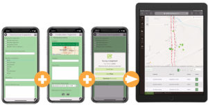
Datafi is a field-to-office data management solution that’s designed to streamline your organization’s operations. Built upon ArcGIS and Esri technology, Datafi simplifies field data collection process by integrating Esri’s mapping and field technologies together in one single work flow. Use Datafi to manage projects, property assessments, incident response and more. Assign tasks to your workforce to complete inspections, capture project photos, perform audits, and collect GIS data.
Why Datafi?
Datafi is a cross-industry solution that is used by cities, counties, contractors, builders, service providers and more for:
Available features
Coast-to-Coast Access
Datafi leverages Esri’s ArcGIS Online platform or ArcGIS Enterprise to ensure your data is available everywhere. Datafi works for individuals and large project teams to coordinate, and manage field data collection operations. Datafi includes data dashboarding tools and allows you to map, edit and maintain your GIS data.
Efficient Management
Using a phone or tablet, manage a project’s inspections and maintenance activities throughout the entire life of the project.


